Around Me
Search
List
Map
Combined
+
+
Guide
Europe
Germany
Austria
Italy
Switzerland
France
Spain
Greece
Great Britain and Northern Ireland
Czech Republic
Liechtenstein
Iceland
Romania
Belgium
Hungary
Portugal
Slovakia
Ireland
Netherlands
Denmark
Norway
Finland
Malta
Sweden
Slovenia
Lithuania
Serbia
Poland
Ukraine
North America
USA
Canada
Costa Rica
Oceania
New Zealand
Australia
Africa
Egypt
South Africa
Asia
Japan
China
United Arab Emirates
Turkey
India
Azerbaijan
Georgia
Iran
Russia
South America
Brazil
Hiking
Europe
Austria
Germany
Italy
Switzerland
Liechtenstein
France
Belgium
Iceland
Romania
Norway
Ireland
Great Britain and Northern Ireland
Denmark
Sweden
Portugal
Spain
North America
USA
Canada
Oceania
New Zealand
Australia
Biking
Europe
Austria
Germany
Switzerland
Italy
Spain
Liechtenstein
Romania
Finland
France
Great Britain and Northern Ireland
Lithuania
Iceland
Ireland
North America
Canada
USA
Swimming
Europe
Austria
Germany
Switzerland
Italy
Romania
Hungary
Iceland
Spain
Belgium
Slovenia
Ireland
Netherlands
Great Britain and Northern Ireland
Malta
North America
Canada
USA
Attractions
Europe
Germany
Austria
Italy
France
Switzerland
Spain
Greece
Czech Republic
Portugal
Slovakia
Great Britain and Northern Ireland
Hungary
Belgium
Netherlands
Iceland
Ireland
Denmark
Malta
Liechtenstein
Norway
Finland
Romania
Serbia
Sweden
Slovenia
Ukraine
Poland
North America
USA
Canada
Costa Rica
Oceania
New Zealand
Australia
Africa
Egypt
South Africa
Asia
Japan
United Arab Emirates
China
Turkey
Russia
Iran
Georgia
India
Azerbaijan
South America
Brazil
Magazine
News
Award
Active
Culture
Tips
Specials
On Tour
Inside
Hike Zweitaelersteig - Stage 1: Waldkirch - Kandel - Image Gallery
Hike
Weather For Hikers
Webcams
Wall
Photos
Zweitaelersteig - Stage 1: Waldkirch - Kandel
Hike
Photos
Weather For Hikers
Webcams
Hikes
Europe
Austria
Germany
Bavaria
North Rhine-Westphalia
Baden-Württemberg
Black Forest
Swabian Jura
Bodensee
Saxony
Lower Saxony
Thuringia
Rhineland-Palatinate
Saarland
Brandenburg
Mecklenburg-Western Pomerania
Saxony-Anhalt
Italy
Switzerland
Liechtenstein
France
Iceland
Great Britain and Northern Ireland
Denmark
All countries in Europe
Romania
Belgium
Norway
Ireland
Sweden
Portugal
Spain
North America
Canada
USA
Oceania
New Zealand
Australia
Magazine
News
Award
Active
Culture
Tips
All magazine categories
Specials
On Tour
Inside
Misc.
The Perfect Match
Travel Guide
Map
Sweepstakes
Surveys
© ZweiTälerLand Tourismus, Fotograf: Clemens Emmler
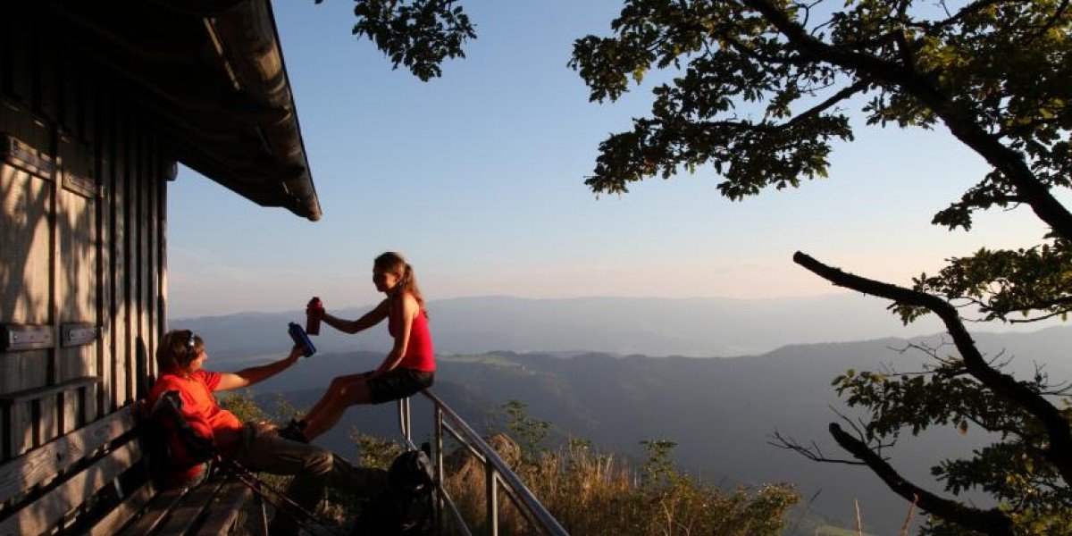
When you reach Thomashütte, you have already done 2/3 of the tour - definitely time for a rest!
© ZweiTälerLand Tourismus, Fotograf: Clemens Emmler
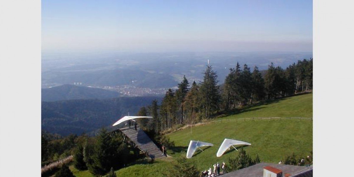
At Berggasthof Kandelhof many paragliders start.
© ZweiTälerLand Tourismus, Fotograf: Clemens Emmler
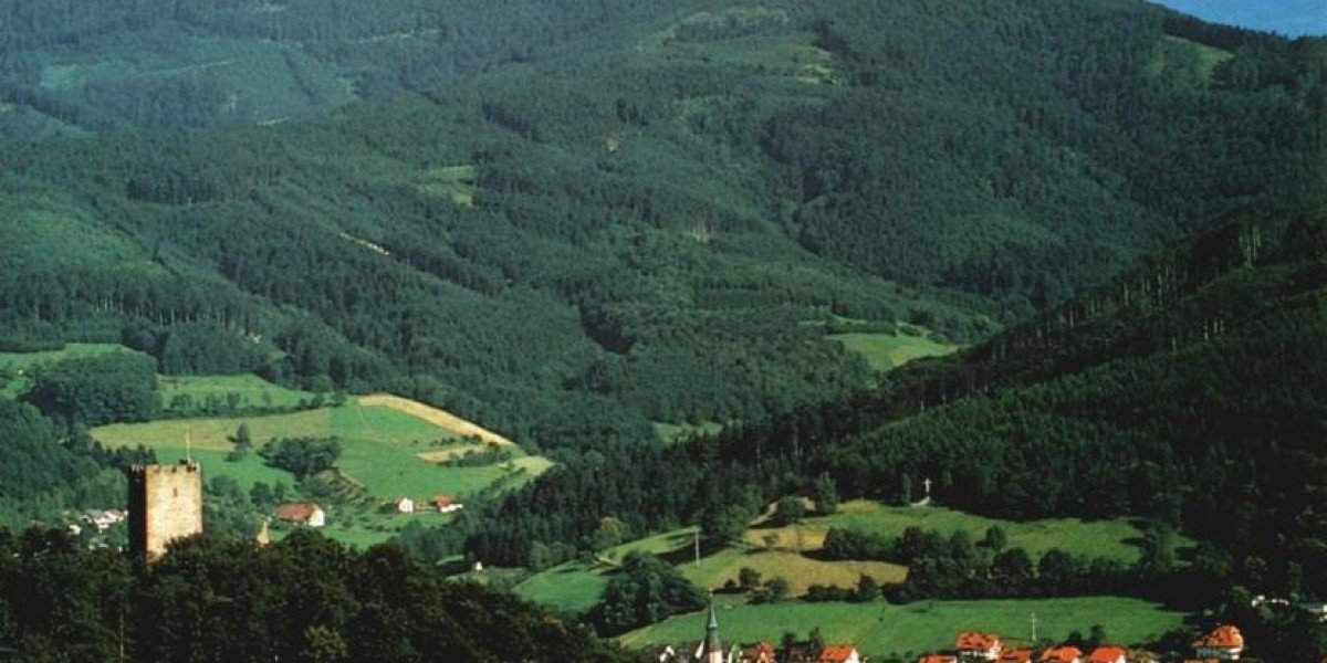
From the summit of Kandel you can look down over Waldkirch and the Black Forest.
© ZweiTälerLand Tourismus, Fotograf: Clemens Emmler
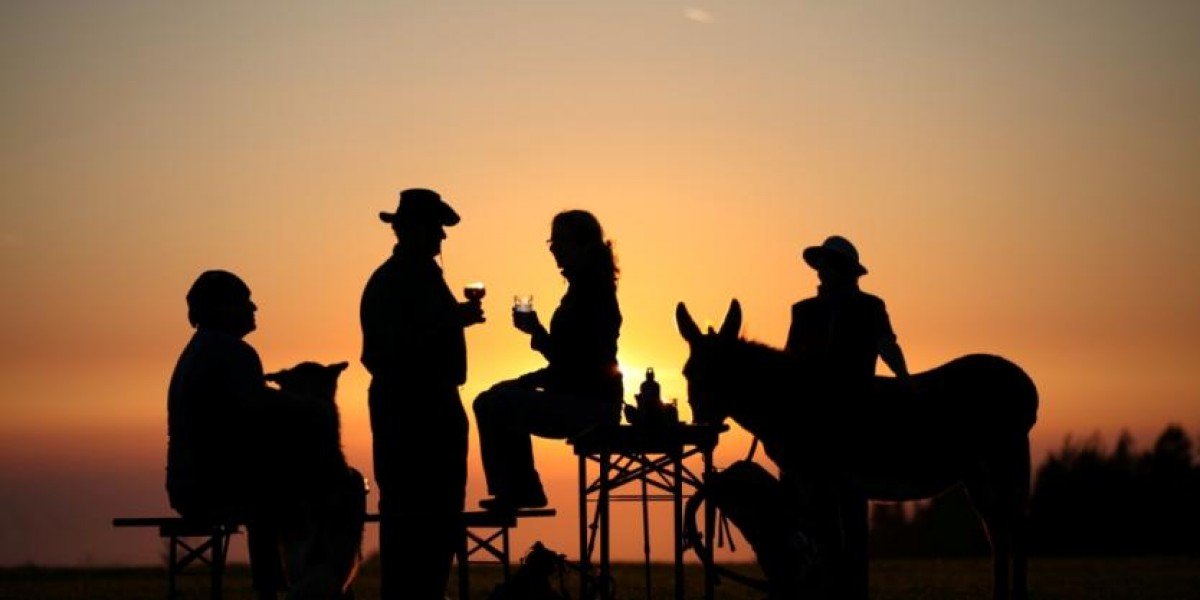
You can spend the night at Berggasthaus Kandelhof, and enjoy the sun set on Kandel mountain.
© ZweiTälerLand Tourismus, Fotograf: Clemens Emmler
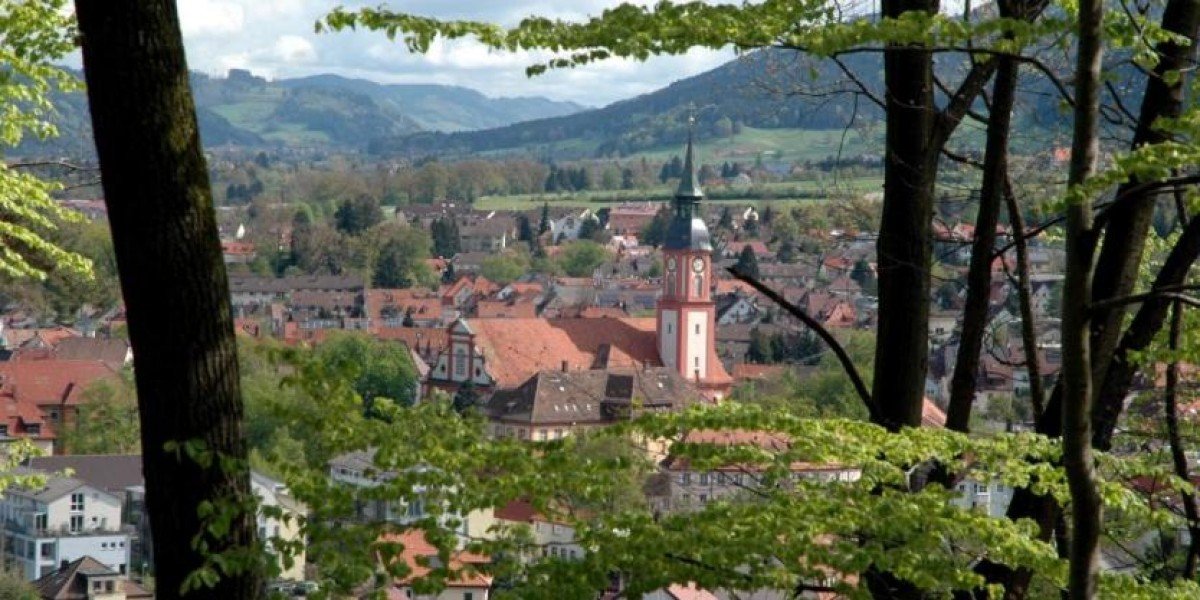
Waldkirch im Breisgau is located at the foot of Kandel mountain.
© ZweiTälerLand Tourismus, Fotograf: Clemens Emmler
Kandelhotel/ Rasthaus am Kandelpass is one of three options to get some food near Kandel summit.
Weather
(1,248
m
)
Today
26
°C
Tue
25
°C
Wed
22
°C
Weather Forecast
Webcams
All Webcams
Hikes Nearby
Zweitaelersteig - Stage 2: Kandel - Simonswald
5.5
km
Zweitaelersteig - Stage 3: Simonswald - Oberprechtal
7.2
km
Zweitaelersteig - Stage 5: Hoehenhaeuser - Waldkirch
15.2
km
Show all
Zweitaelersteig - Stage 4: Oberprechtal - Hoehenhaeuser
19.3
km
About the author
Schwarzwald Tourismus GmbH
last update on 28 May 2019
Rate the Hike
0
(1)
Share this page
Share
Tweet
Mail
Advertisement
Login