


Route description
This is the fourth of five stages that make up Zweitälersteig at nature park Südschwarzwald, following stages 1, 2 and 3. This leg of the trail leads from Oberprechtal to Höhenhäuser. Apart from the ascent to Huberfelsen, most of this diverse tour is not too steep.
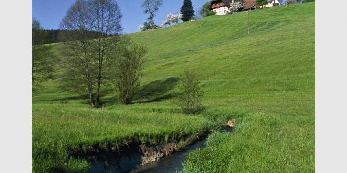
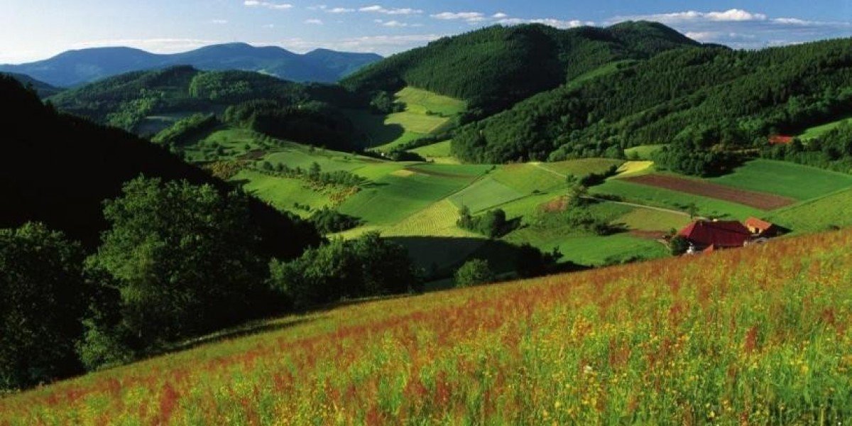
Starting at Hinterprechtal valley, first follow Wittenbach and later Wittenbächle river. After 1.5km/.9mi you cross the stream and on a path past Hirschfelsen, you ascend to Huberfelsen. The steepest part of the tour is now behind you, and you can enjoy the view from Huberfelsen mountain. Shortly after, you get to the highest point of the hike - Prechtaler Schanze (836m/2,743ft). Over the ridge and through a meadow and hazel bush landscape, descend to Pfauenkreuz. From here, it is only 2km/1.2mi to Landwassereck, one of the most beautiful viewing points in the region, from where you can look over the valley and to the Rhine plane. Cross the forest on a gravel path, and pass at the foot of Holzerkopf, Benediktkopf, and Finsterkapf mountains.
Afterwards, a path leads you down towards Gasthaus Sonnhalde inn. Cross the street at Heidburg pass, and follow the asphalted road north-westbound. If you need a coffee break, stop at Café Pension Pfaus, by turning right towards Schmiedershof at the next crossroads. As soon as you are back on the main route, you soon pass a junction to Funi. Here you can find Funihof and Funi's Vesperstube. Just after this junction, follow the gravel path to the right. It becomes a forest path and leads you to Heidburg castle. Moderately ascending, you pass Biereck. You have almost reached this stage's destination, Höhenhäuser. However, you first have to ascend another 150m/492ft.
The fifth and last leg of the multi-day Zweitälersteig hiking trail leads you from Höhenhäuser to Waldkirch.
Where to eat
Opportunities to buy something to eat are only available at the second part of the stage, so you should pack provisions and sufficient water.
Café Pfaus Heidburg and Funihof require a little detour from the main route. At the end of the tour, you can reward yourself with a meal at Höhengasthaus zum Kreuz.
Interesting facts
- You're traveling a distance of 24 km on this moderate trail. This makes it a relatively long hike. The average length of all hikes in Baden-Württemberg is 49 km.
- You're facing an uphill climb of 666 vertical meters on this hike. The highest point of the track is 827 m above sea level.
- The trail is one of the dog friendly hikes in the region.
- Make sure to bring sturdy footwear on this track. Hiking boots are highly recommended. There are places to buy beverages and food along the track. However it’s always recommended to bring enough water and food along with you.
Getting here
By car
From Waldkirch, follow B294 to Elzach. Take the first exit at the first roundabout, and the second exit at the next one. After about 1km/.6mi you get to another roundabout, which you leave at the second exit. Afterwards, turn right at the third crossing and onto L107 (Talstraße), which you follow to Oberprechtal. At the village of Oberprechtal, keep right to get to Wittenbach.
Coming from Triberg, you travel on L109. You get to Oberprechtal-Wittenbach via Schonal.
Parking is available at Gasthof Rössle.
Public transportation
From Waldkirch, take Breisgau S-Bahn to Elzach. From here, bus line 7274 takes you to Oberprechtal Rößle bus stop.
From Triberg, go straight on bus line 7274 and get off at Oberprechtal Rößle.
