Around Me
Search
List
Map
Combined
+
+
Guide
Europe
Germany
Austria
Italy
Switzerland
France
Spain
Greece
Great Britain and Northern Ireland
Czech Republic
Liechtenstein
Iceland
Romania
Belgium
Hungary
Portugal
Slovakia
Ireland
Netherlands
Denmark
Norway
Finland
Malta
Sweden
Slovenia
Lithuania
Serbia
Poland
Ukraine
North America
USA
Canada
Costa Rica
Oceania
New Zealand
Australia
Africa
Egypt
South Africa
Asia
Japan
China
United Arab Emirates
Turkey
India
Azerbaijan
Georgia
Iran
Russia
South America
Brazil
Hiking
Europe
Austria
Germany
Italy
Switzerland
Liechtenstein
France
Belgium
Iceland
Romania
Norway
Ireland
Great Britain and Northern Ireland
Denmark
Sweden
Portugal
Spain
North America
USA
Canada
Oceania
New Zealand
Australia
Biking
Europe
Austria
Germany
Switzerland
Italy
Spain
Liechtenstein
Romania
Finland
France
Great Britain and Northern Ireland
Lithuania
Iceland
Ireland
North America
Canada
USA
Swimming
Europe
Austria
Germany
Switzerland
Italy
Romania
Hungary
Iceland
Spain
Belgium
Slovenia
Ireland
Netherlands
Great Britain and Northern Ireland
Malta
North America
Canada
USA
Attractions
Europe
Germany
Austria
Italy
France
Switzerland
Spain
Greece
Czech Republic
Portugal
Slovakia
Great Britain and Northern Ireland
Hungary
Belgium
Netherlands
Iceland
Ireland
Denmark
Malta
Liechtenstein
Norway
Finland
Romania
Serbia
Sweden
Slovenia
Ukraine
Poland
North America
USA
Canada
Costa Rica
Oceania
New Zealand
Australia
Africa
Egypt
South Africa
Asia
Japan
United Arab Emirates
China
Turkey
Russia
Iran
Georgia
India
Azerbaijan
South America
Brazil
Magazine
News
Award
Active
Culture
Tips
Specials
On Tour
Inside
Hike Barefoot loop Tannheim
Hike
Weather For Hikers
Webcams
Wall
Photos
Barefoot loop Tannheim
Hike
Photos
Weather For Hikers
Webcams
Hikes
Europe
Austria
Tyrol
Paznaun - Ischgl
Zillertal
Stubai
Tannheimer Tal
East Tyrol
Tyrolean Oberland
Alpbachtal Seenland
St.Anton am Arlberg
Region Seefeld
Wildschönau
Kitzbühel Alps - St. Johann - Oberndorf - Kirchdorf
Pillerseetal
Kitzbühel
Pitztal
Tyrol West
Kaiserwinkl
Lechtal
Tyrolean Zugspitz Arena
Region Hall - Wattens
Ötztal
Kitzbühel Alps - Brixental
First tourist region in Zillertal
Ferienregion Imst
Naturparkregion Reutte
Innsbruck and its holiday villages
Silberregion Karwendel
Salzburg
Vorarlberg
Styria
Carinthia
Upper Austria
Lower Austria
Vienna
Burgenland
Germany
Italy
Switzerland
Liechtenstein
France
Iceland
Great Britain and Northern Ireland
Denmark
All countries in Europe
Romania
Belgium
Norway
Ireland
Sweden
Portugal
Spain
North America
Canada
USA
Oceania
New Zealand
Australia
Magazine
News
Award
Active
Culture
Tips
All magazine categories
Specials
On Tour
Inside
Misc.
The Perfect Match
Travel Guide
Map
Sweepstakes
Surveys
Elevation
Min:
1,088
m
Max:
1,094
m
Uphill:
27
m
Edit marker position
Upload GPS data
To Go
Print Version
Download .GPX
Download .KML
Nearby
From Tannheim to Einstein summit
0
km
From Zoeblen to Einstein summit
3.2
km
Loop trail Lohmoos
3.2
km
Show all
Zipfelalpe
4.5
km
Vilsalpsee
4.5
km
Schneetalalpe - Gimpelhaus
7.3
km
Hike Heaven Hotspur Path - Allgäu Hiking Trilogy
26.8
km
Water Runner Path - Allgäu Hiking Trilogy
51
km
About the author
Tourismusverband Tannheimer Tal
last update on 21 May 2019
Rate the Hike
0
(3)
Share this page
Share
Tweet
Mail
Advertisement
Facts
Difficulty
Easy
Distance:
3
km
Duration:
30 min
Loop trail
Min:
1,088
m
Max:
1,094
m
Uphill:
27
m
Best Season
JAN
FEB
MAR
APR
MAY
JUN
JUL
AUG
SEP
OCT
NOV
DEC
Trail characteristics
Asphalt
Dirt road
Forest track
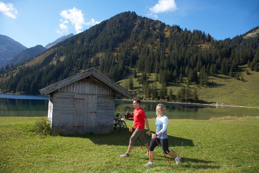
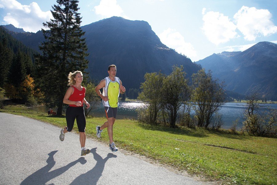
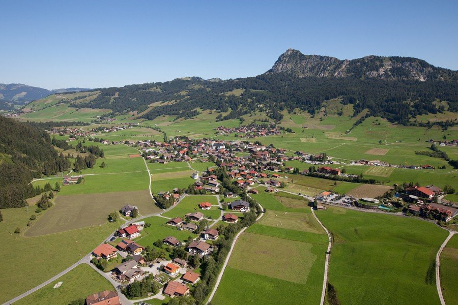
Image Gallery
See all images
Weather
(1,100
m
)
Today
32
°C
Fri
31
°C
Sat
26
°C
Weather Forecast
Webcams
All Webcams
Contact
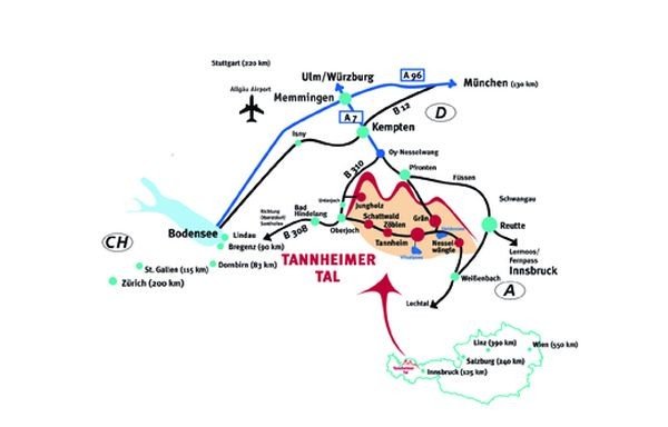
Tourismusverband Tannheimer Tal
Vilsalpseestraße 1
6675
Tannheim
E-Mail
www.tannheimertal.com
%69%6e%66%6f%40%74%61%6e%6e%68%65%69%6d%65%72%74%61%6c%2e%63%6f%6d
Phone
+43 (5675) 6220-0
Fax
+43 (5675) 6220-60
Image Gallery
See all images
Comments
Rate the Hike
Send
No posts available yet:
Nobody has posted on the wall of the Hike "Barefoot loop Tannheim" yet
Be the first to comment!
Login