Route description
All the way up to the top station
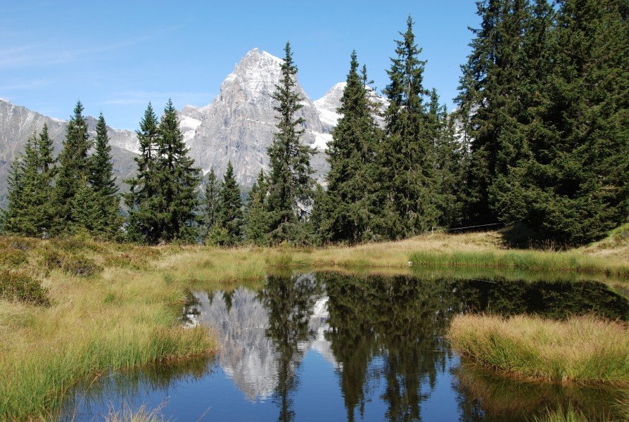
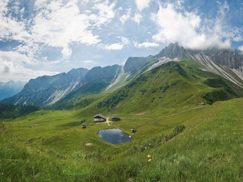
The family-friendly hike starts at the top station of the cableway Ladurn. Your tour begins with a smaller and steeper segment of hiking uphill to the Ladurner Lacken. On your way you will pass a small wetland habitat. This includes two lakes which look beautiful with the surrounding landscape. You continue your hike on the Dolomieu Almen Weg (trail) marked with the number 6 and you will end up in a forested area. Slowly but steadily you will hike up a winding trail up the mountain until you reach the first junction. Keep left and you should now be on the Ladurner Rundweg (translated: Ladurner circuit route). At about 2000 meters (6561 ft) you will have reached the highest point of your tour. Take some time to rest and recover your strength. The panoramic view onto the valley is incredible from the summit Wastenegg.
Reach incredible heights on the circuit route
Your tour continues hiking from the mountain crest down to the junction of Teissljöchel. Take a sharp left here and follow the trail marked with the number 34 called Ladurner Rundweg (translated: Ladurner circuit route). After a short while you will reach the Edelweißhütte mountain hut at 1952 meters (6404 ft). Here you could make a rest-stop and grab a bite to eat. At the intersection shortly before the hut stay on the right walking continuously downhill. Stay parallel to the Bichlbach creek and you will not lose your way. Soon you will reach the starting point of your hike.
Where to eat
There is a restaurant at the top station where you can eat before or after your tour. About halfway on your tour you get another opportunity to take a break and eat at the Edelweißhütte mountain hut.
Interesting facts
- You're traveling a distance of 3 km on this easy trail. The hike is therefore not too long. Average length of all hikes in South Tyrol is 12 km.
- You're facing an uphill climb of 70 vertical meters on this hike. The track is therefore relatively flat. The highest point of the track is 2,006 m above sea level.
- Make sure to bring sturdy footwear on this track. Hiking boots are highly recommended. If you get hungry along the way, there are places to rest and get food. Nevertheless it’s recommended to also have enough water and food in your backpack when hiking or biking.
Highlights of the tour
One of the main highlights is the panoramic view. From the summit Wastenegg you get a wonderful view onto the valley and the surrounding landscape and nearby mountains. You are able to look down onto steep rock face and other rock formations of the Pflerscher Tribulaun mountain. You can either climb the mountain at 3087 meters (10127 ft) or stay at the look-out point and simply enjoy the view.
You will walk by the Silberböden, a site where there used to be a mining sector and historically a very interesting place to visit. Apart from these highlights you will walk through untouched and breathtaking nature so you can take a break from stressful everyday life and just relax while enjoying this amazing landscape.
Getting here
By car
Starting in Innsbruck
Drive onto the Inntal Autobahn (highway) A12 until you can change onto the Brennerautobahn (highway) A13. Continue to follow the road for the next 34,5 kilometers (21.4 mi) until you can drive onto the E45. Take the exit in the direction of SS12 and follow the road. Turn right onto the Pflerscherstraße street and continue on that road until you reach the valley station of the cableway.
Starting in Bozen
Leave the city driving south and onto the SS12. From there you will soon get to change onto the Brennerautobahn (highway) A22 and follow the road for about 60 kilometers (37.3 mi). Take the exit in the direction of Sterzing and crossing two roundabouts you will end up on the Plerscherstraße street on your left-hand side. Continue on that road until you reach the valley station of the cableway.
Public transportation
With the train you can reach Gossensass (village) regularly. From here there is a bus to the valley station Ladurn.