Around Me
Search
List
Map
Combined
+
+
Guide
Europe
Germany
Austria
Italy
Switzerland
France
Spain
Greece
Great Britain and Northern Ireland
Czech Republic
Liechtenstein
Iceland
Romania
Belgium
Hungary
Portugal
Slovakia
Ireland
Netherlands
Denmark
Norway
Finland
Malta
Sweden
Slovenia
Lithuania
Serbia
Poland
Ukraine
North America
USA
Canada
Costa Rica
Oceania
New Zealand
Australia
Africa
Egypt
South Africa
Asia
Japan
China
United Arab Emirates
Turkey
India
Azerbaijan
Georgia
Iran
Russia
South America
Brazil
Hiking
Europe
Austria
Germany
Italy
Switzerland
Liechtenstein
France
Romania
Belgium
Iceland
Norway
Ireland
Great Britain and Northern Ireland
Denmark
Sweden
Spain
Portugal
North America
USA
Canada
Oceania
New Zealand
Australia
Biking
Europe
Austria
Germany
Switzerland
Italy
Liechtenstein
Romania
Spain
France
Great Britain and Northern Ireland
Lithuania
Finland
Iceland
Ireland
North America
Canada
USA
Swimming
Europe
Austria
Germany
Switzerland
Italy
Romania
Hungary
Iceland
Spain
Belgium
Slovenia
Ireland
Netherlands
Great Britain and Northern Ireland
Malta
North America
Canada
USA
Attractions
Europe
Germany
Austria
Italy
France
Switzerland
Spain
Greece
Czech Republic
Portugal
Slovakia
Great Britain and Northern Ireland
Hungary
Belgium
Netherlands
Iceland
Ireland
Denmark
Malta
Liechtenstein
Norway
Finland
Romania
Sweden
Serbia
Slovenia
Poland
Ukraine
North America
USA
Canada
Costa Rica
Oceania
New Zealand
Australia
Africa
Egypt
South Africa
Asia
Japan
United Arab Emirates
China
Iran
Georgia
India
Azerbaijan
Turkey
Russia
South America
Brazil
Magazine
News
Award
Active
Culture
Tips
Specials
On Tour
Inside
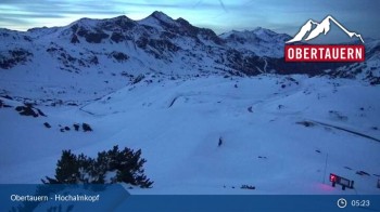
Webcam Gamsleiten Gipfel, 2,249 m
Hike
Weather For Hikers
Webcams
Wall
Photos
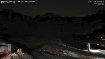
Flachauwinkl - Südwienerhütte - Spirzinger
Hike
Photos
Weather For Hikers
Webcams
Hikes
Europe
Austria
Tyrol
Salzburg
Salzburg's world of sport
Grossarltal
Gasteinertal
Zell am See - Kaprun
Saalbach-Hinterglemm
Lungau
Hochkönig
Nationalpark Hohe Tauern
Obertauern
Saalfelden-Leogang
Saalachtal
Vorarlberg
Styria
Carinthia
Upper Austria
Lower Austria
Vienna
Burgenland
Germany
Italy
Switzerland
Liechtenstein
France
Iceland
Great Britain and Northern Ireland
Denmark
All countries in Europe
Romania
Belgium
Norway
Ireland
Sweden
Portugal
Spain
North America
Canada
USA
Oceania
New Zealand
Australia
Magazine
News
Award
Active
Culture
Tips
All magazine categories
Specials
On Tour
Inside
Misc.
The Perfect Match
Travel Guide
Map
Sweepstakes
Surveys
© Feratel
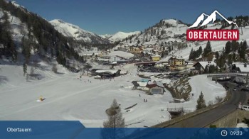
Here you can see Obertauern from the Gamsleitenspitze
Webcam broken? Description wrong?
Please, share your knowledge with our staff. Tell us what is wrong with this webcam.
E-Mail
Message
Send
Elevation:
2,249
m
Today's webcam images (Local Time: 19:50)
00:00
02:00
04:00
06:00
07:00
08:00
10:00
12:00
14:00
Latest
Webcam archive
Advertisement
Travel Deals & Tips
Advertisement
Webcams nearby
Obertauern - Zehnerkar
Apartement House Petergstamm in Obertauern
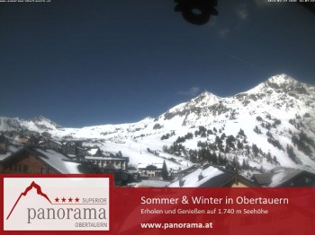
View at the slopes from the Panorama hotel
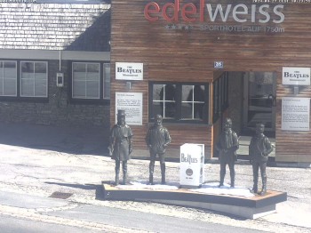
Hotel Edelweiss
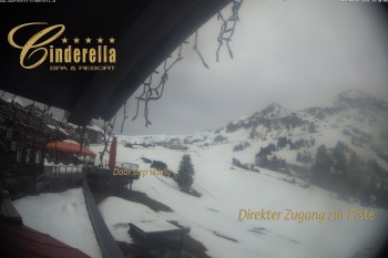
Cinderella hotel Ski Obertauern
View from Plattenkar
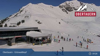
Obertauern - Grünwaldkopf
View from the hotel Breitlehenalm
Top Station Hochalmkopf - Obertauern
Obertauern: View Hotel Seekarhaus
Nearby
Flachauwinkl - Marbachtal
1.9
km
Hight Tour Zauchensee - Hinterkogel - Lackenkogel - Flachau
4.1
km
4 Summits Tour Zauchensee
4.1
km
Show all
Flachauwinkl - Untere und Obere Ennsalmen - Benzeck
5.8
km
Obertauern - Felseralm - Hirschwandsteig - Südwienerhütte - Flachauwinkl
6.3
km
High Ropes Course - Alpincenter Salzburger Sportwelt Flachau
8
km
High-Altitude Hike Kleinarl
8.6
km
Grießenkareck hight trail
10.8
km
Flachau - Lackenkogel
10.9
km
Around the Koppen
11
km
Flachau - Wiesenweg - Schloss Höch - Reiteck - Badesee Reitdorf
11
km
Flachau - Grießenkareck - Frauenalm - Flachauwinkl
11.1
km
Marbachalmen MTB tour
11.1
km
Hiking Tour Salzburger Almenweg (stage 21) from Flachau to Zauchensee
11.2
km
Hike to the Blue Lakes Blauseen - Tweng
14.3
km
Advertisement
Login

 00:00
00:00  02:00
02:00  04:00
04:00 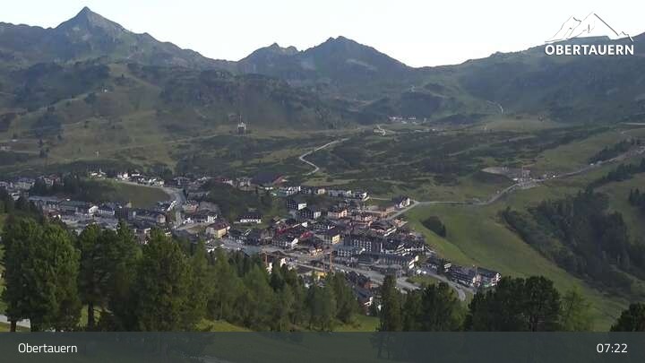 06:00
06:00 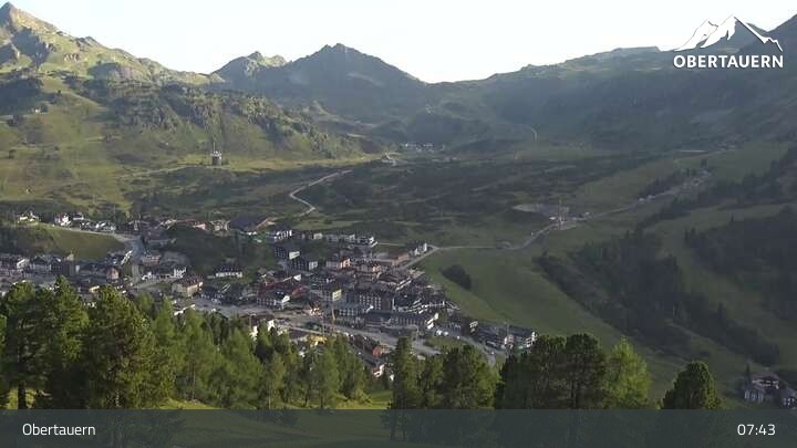 07:00
07:00 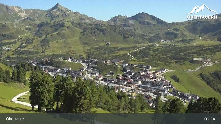 08:00
08:00 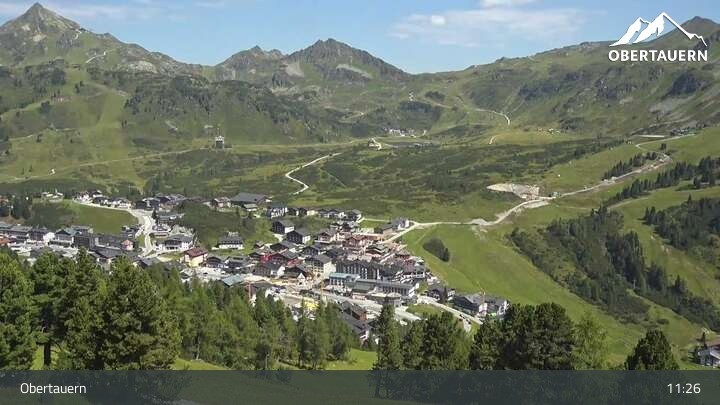 10:00
10:00 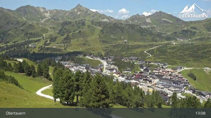 12:00
12:00 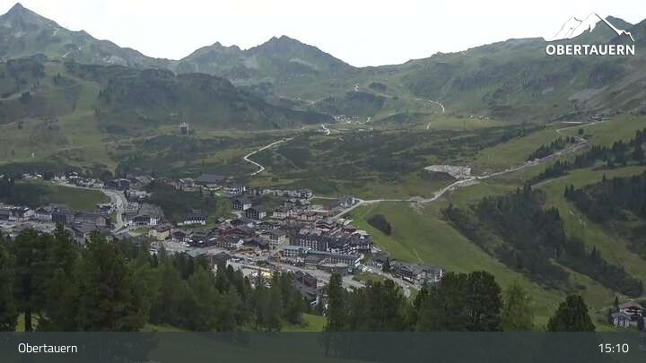 14:00
14:00 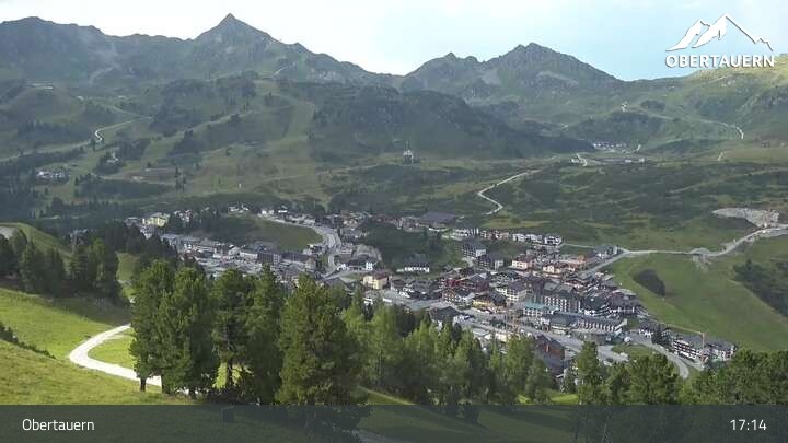 Latest