Route description
An idyllic forest walking trail goes to the Südwienerhütte, which is situated inmidst the mountain world of Radstädter Tauern. Reaching the peak of the Spirzinger (2066 m) completes this great hike.
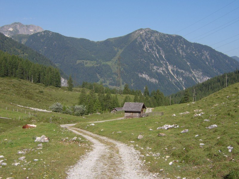
Highway chapel in Flachauwinkl - via forest road to the "Unterbichlhütte" - path Nr. 711 - turn left after that and carry on path Nr. 711 - Südwienerhütte (ca. 1802m) - Spirzinger (2066m) path Nr. 27 - return the same way until Südwienerhütte and then via Hafeichtkapelle back again to motorway chapel path Nr. 26.
Step security is necessary on the last part to the peak Spirzinger.
Where to eat
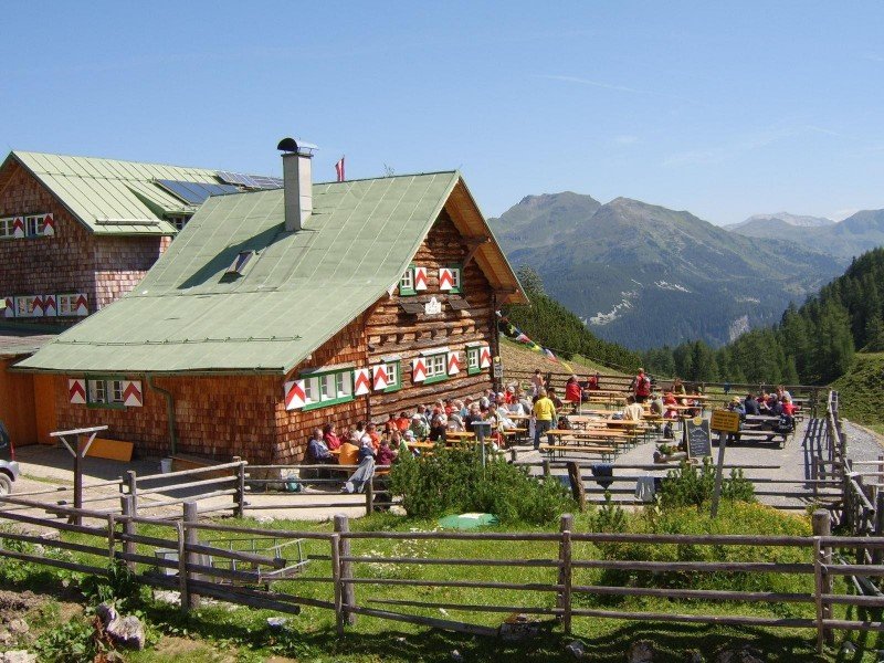
Along the tour you have different possibilities for a comfortable stop at a hut. After the first 1.5 km you reach the Unterbichlhütte. If you still need no break here, you hike further to the Südwienerhütte (about 3 km). The sunny terrace invite you for a stay and enjoy the view to the mountains. On the way back you can make a small side trip to the Scharfetthütte (before the "Hafeichtenkapelle"). Here you can enjoy self-made snacks like bread with butter, cheese or bacon and a glass of milk.
Interesting facts
- You're traveling a distance of 12 km on this moderate trail. The average length of all hikes in Salzburg is 15 km.
- You're facing an uphill climb of 922 vertical meters on this hike. The high point of the hike is located at an elevation of 2,043 m.
- Taking your dog on this trail shouldn’t be a problem. (See all dog friendly hikes in Salzburg.)
- Sturdy hiking boots are recommended on this track. There are places to buy beverages and food along the track. However it’s always recommended to bring enough water and food along with you.
Videos
Highlights of the tour
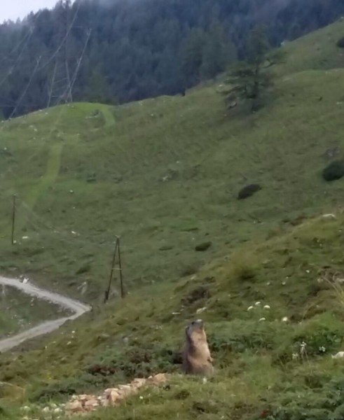
If you are quiet and with some luck you can see some groundhogs ("Mangei" in dialect) and you make some pictures.
Variations
Who still feels to go on after the hike to the "Südwienerhütte", can hike to the peaks Spirzinger (2066 m) and Spazeck (2065 m).
Equipment
For a trip until the summits Spirzinger and Spazeck you need trekking or mountain boots. If you want you also can take hiking sticks with you.
Getting here
by car
You can reach Flachau easily via the A10 Tauern motorway (exit 66). From Flachau along the "Flachauwinklstraße" till the end of the valley (Gasthofalm) and from there to the highway chapel. There is a parking space at highway chapel.
by public transport
With the "Sportwelt-Bus" you get to the bus station "Flachauwinkl "Gasthofalm".