Contents
Route description
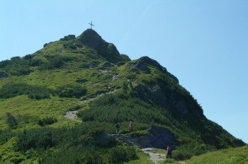
Flachau center - towards valley station starjet 1 & 2 - to Pfeiffei Alm - cross the field to hiking path Nr. 42 - carry on path Nr. 41/42 - turn right above the "Berggasthof Latschenhof" - pass the War Memorial crosses and follow the track to the Grießenkareck (1991 m) - carry on via Saukarfunktel (2028 m) - to Saukarkopf (2024 m) - junction Frauenalm Nr. 41 - walk further to the valley Flachauwinkel Nr. 45 - from there walk towards Flachau Nr. 1 or take the Sportwelt-Bus from the bus stop "Flachau Steinfeld"
Take note of the opening hours from the lift (star jet 1 & 2)
Where to eat
Possibility for lunch: Zum Holzwurm, Pfeiffei Alm, Waldgasthof, Hofalm, Jandlalm, Latschenhof, Frauenalm, Seestüberl
Interesting facts
- With an overall length of 21 km the hike is among the 5 longest hikes in Salzburg available on TouriSpo.
- You're facing an uphill climb of 1179 vertical meters on this hike. This makes the hike one of the 10 hikes with the most ascent in Salzburg. The highest point of the track is 1,986 m above sea level.
- Make sure to bring sturdy footwear on this track. Hiking boots are highly recommended. There are places to buy beverages and food along the track. However it’s always recommended to bring enough water and food along with you.
Videos
Highlights of the tour
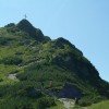
In the summer main season the ascent with the two chair lifts on the mountain makes everyone happy. At the top of the summit, a wonderful outlook and farsightedness reward all efforts.
Equipment
As parts of the route lead over rocky ground, you should definitely wear trekking or mountain boots.
Getting here
by car
You can reach Flachau easily via the A10 Tauern motorway (exit 66). The car you can leave at the parking space directly in the center of Flachau, nearby the BBF-Center.
by public transport
With the "Sportwelt-Bus" you get to the bus station "Flachau Ortsmitte". From there you can walk to the ground station starjet 1.


