Route description
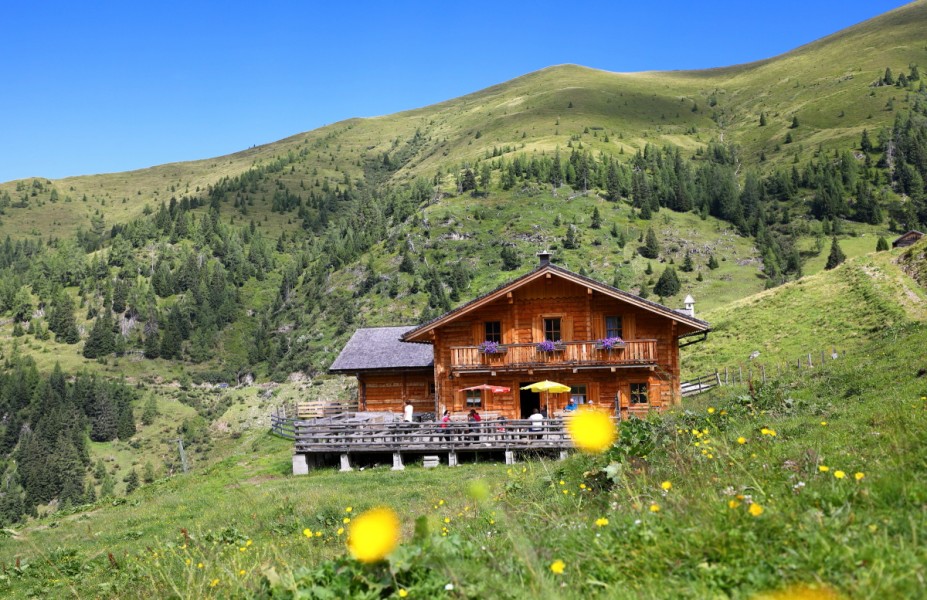
The hike starts at Hallmoosalm in Hüttschlag. Hike partly on a forest road and partly through a forest up to Glettnalm. For a more athletic option walk via alp Ragglalm (closed down). A beautiful trail will guide over alpine meadows until you will reach the forest road again. There the path is even and leads into the cirque of Glettnalm. The alpine hut is located in the middle. Close to the hut there is a wayside cross to halt at. Perfect to rest and enjoy this unique idyll.
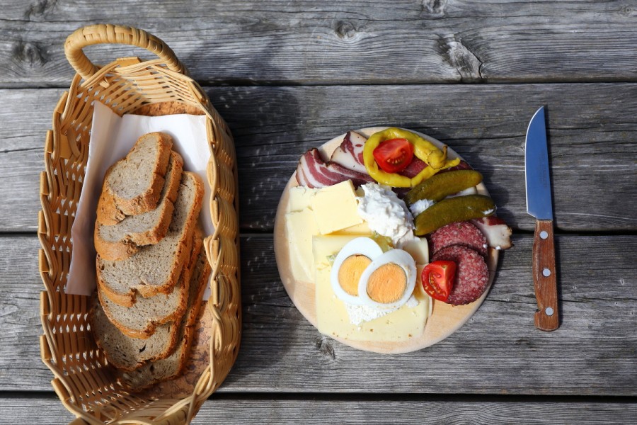
Up there you will get rewarded with a great meal consisting of home-made products. Above the hut on 2433 m/7982ft you will see the mountain „hohe Klingspitz“ whose peak glows in the sunset light.
Route description a): (Trail 52) Take the car or the cab „Wandertaxi“ via road Seilsitzberg (Hüttschlag/Karteis) to Hallmoosalm, 1300 m/4265ft (closed down) -parking available- keep straight- turn right at the first junction (trail 52) continue straight -pass the junction to Karteisalm- after about ½ h turn left on a new laid out forest road, which is first winding and finally on top it leads into the cirque of Glettnalm, 1760 m/5774ft (about 2 ½ h) – take the same way back or the alternative route.
Route description b): (Trail 52A) Take the car or the cab „Wandertaxi“ via road Seilsitzberg (Hüttschlag/Karteis) to Hallmoosalm, 1300m/4265ft (closed down) – parking available- keep straight- turn right at the first junction- continue straight (passed the junction to Karteisalm and passed the new forest road to Glettalm)- after approximately ¾ h the forest road becomes a tractor road and leads to Ragglalm, 1646 m/5400ft (closed down) – from there ascend on a beautiful alpine road, which eventually ends in the forest road (number 52)- short ascent on the forest road- eventually the path will lead slightly downwards to Glettnalm, 1760 m/5774ft – take the same way back or the alternative route a).
Interesting facts
- You're traveling a distance of 12 km on this moderate trail. The average length of all hikes in Salzburg is 15 km.
- You're facing an uphill climb of 530 vertical meters on this hike. The hike takes you to an elevation of 1,760 m.
- You shouldn’t forget to bring your hiking boots. There are some sections on the trail where sturdy footwear is required. There are places to buy beverages and food along the track. However it’s always recommended to bring enough water and food along with you.
Highlights of the tour
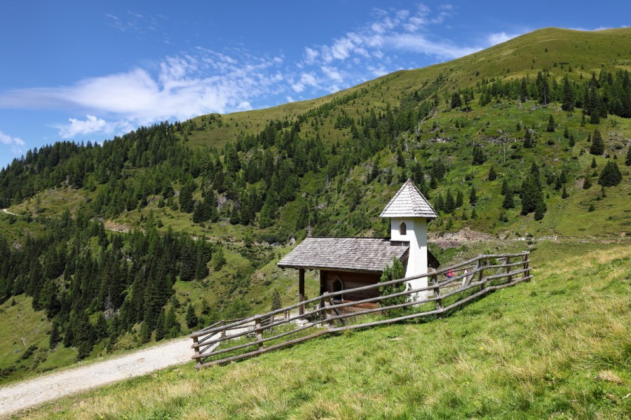
Close to Glettnalm there is a wayside cross, which is ideal to halt at. There you can also enjoy the fantastic view.
Equipment
Hiking boots with grip sole, map (Wanderkarte tappeiner number 311)
Getting here
By car:
Take the car or the cab „Wandertaxi“ to Hallmoosalm in Hüttschlag.
Postbus number 540, „Wandertaxi“ Großarl
Hüttschlag- Hallmoosalm