

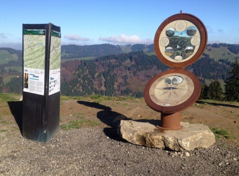
Route description
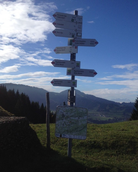
From the Top Station over Moos Alp to Alp Sonnhalde
The hike starts and ends at the top station of Hündelbergbahn. From there, first start towards Moos Alp along the ridge. Keeping right, you will come across the so-called Fuchslöcher (fox holes). At the next junction, go left until you reach Alp Sonnhalde.
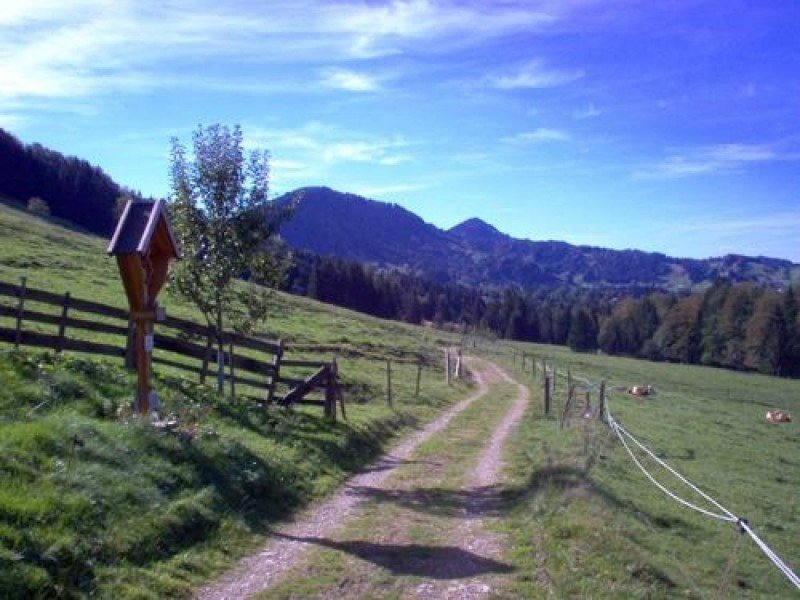
From Alp Sonnhalde to Buchenegg Waterfalls
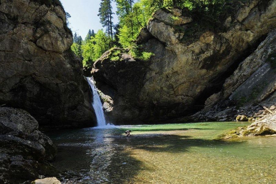
Now you walk steeply downhill. At Tarzansteg, you cross river Weißach. After a bit of uphill walking, you go to Alp Neugschwend, then to the right and back downhill. You will reach river Weißach again, and see Buchenegg's waterfalls, which are a special attraction.
Way Back to the Top Station
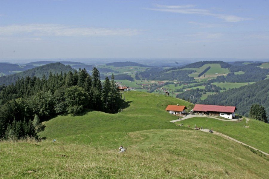
On the opposite side, a path leads uphill to a small car park. Turn right, and then left, to get back to Hündlekopf and the top station where you started.
Where to eat
There are four dining options on this hike. Moos Alp is very popular with hikers and holidaymakers. It is closed on Wednesday. Alp Sonnhalde is open daily during the summer. A third option is Bärenschwand Alp, which is only 30 minutes from the base station. Before or after your tour, you can eat at Hündle top station.
Interesting facts
- You're traveling a distance of 11 km on this strenuous trail. Average length of all hikes in Bavaria is 49 km.
- You're facing an uphill climb of 491 vertical meters on this hike. The high point of the hike is located at an elevation of 1,105 m.
- This strenuous hike is perfect for the whole family. The hike is also perfect if the kid’s wanna bring their dog on the trip. (See all dog friendly hikes in Bavaria.)
- Sturdy hiking boots are recommended on this track. If you get hungry along the way, there are places to rest and get food. Nevertheless it’s recommended to also have enough water and food in your backpack when hiking or biking.
Video
Highlights of the tour
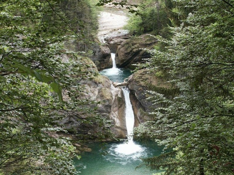
- Buchenegg waterfalls
- Weißach gorge
- Beautiful crocus blossom
Variations
The trail is marked as a circular path, so you can also walk it the other way around.
Equipment
Hiking boots are absolutely recommended. You will need stamina as well as sufficient provisions and weather proof clothing.
Getting here
By car
From north, leave motorway A7 at Allgäuer Kreuz to change onto A980 towards Lindau. Leave the road at exit Waltenhofen and drive towards Immenstadt on B19. From there, follow the signs pointing to Obertaufen/Lindau on the B308. Just before Obertaufen you will get to Hündle. The base station is on your left-hand side, where Hündlebahn will bring you to the starting point of the hike.
Coming fromMunich/Memmingen, follow motorway A96 to exit Wangen im Allgäu. Change onto B32. At the next bigger junction, turn right towards Lindau, but turn left onto b32 shortly after. Follow the road until you can turn onto B308 towards Oberstaufen. Stay on this road, pass Oberstaufen, and drive to Händle. The base station is on your right-hand side.
From Lindau, follow B308 to Oberstaufen. Cross the town and drive to Hündle, where the base station is on your right-hand side.
Coming from Switzerland or Austria, follow motorway A96 towards Lindau. At exit Lindau change onto B308 towards Oberstaufen. After you've crossed the town, you get to Hündle, where the base stationis on your right. The lift will get you to the top station, where the hike begins.
Public transportation
Oberstaufen railway station is accessible from all larger train stations. We recommend the train line from Munich/Ulm via Kempten to Lindau. From Lindau, there are regular trains calling at Oberstaufen.
From Oberstaufen, a bus goes to Immenstadt. Take this bus to the stop Knechtenhofen/Hündelift, which is right at the base station of Hündlebergbahn.