

Description
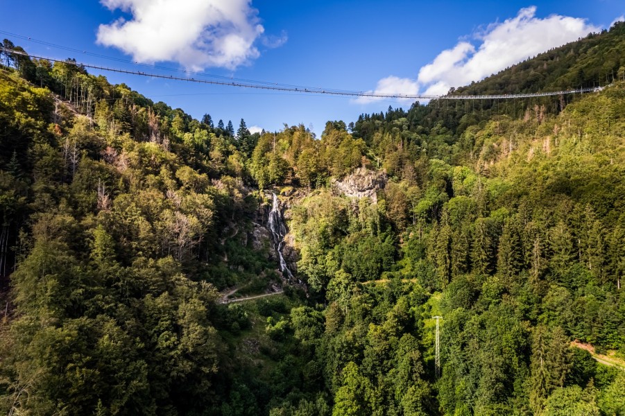
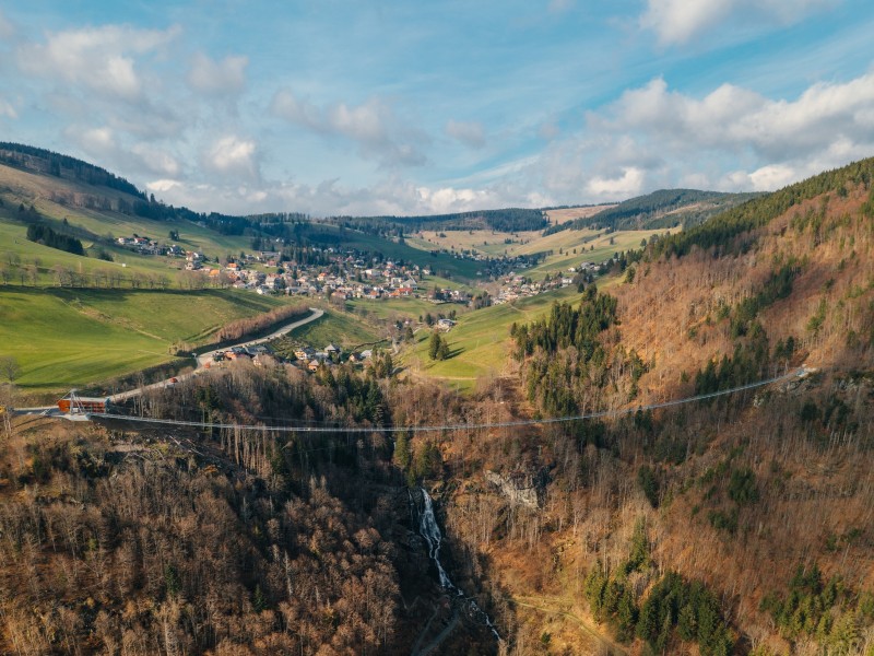
Todtnau Waterfall is located between the districts of Todtnauberg and Aftersteg in the Southern Black Forest and, with a total drop of 97 metres, ranks among the highest natural waterfalls in Germany.
It is fed by the Stübenbach stream, which rises on the 1,386-metre Stübenwasen in the Feldberg area. The water cascades down several tiers — partly in free fall, partly sliding over granite rock faces — into the valley below. The largest single tier measures around 60 metres, making it the highest single drop of any waterfall in Germany's low mountain ranges. On average, 210 litres of water flow over the rocks every second. The waterfall has been protected as a natural monument since 1987.
Hiking trails along the waterfalls
From the village of Aftersteg, a wide, barrier-free forest track leads to the base of the main waterfall and is suitable for all-terrain pushchairs. At the foot of the main tier you'll find the most popular viewpoint, offering views both up towards the falls and down into the valley. The upper tiers can be reached via narrow hiking trails with some steep steps, providing a more immersive nature experience. The trail on the left-hand side of the waterfall is particularly rewarding, with ever-changing perspectives on the rushing water. Please note that admission to the Todtnau Waterfalls is subject to a fee.
Blackforestline and other nearby attractions
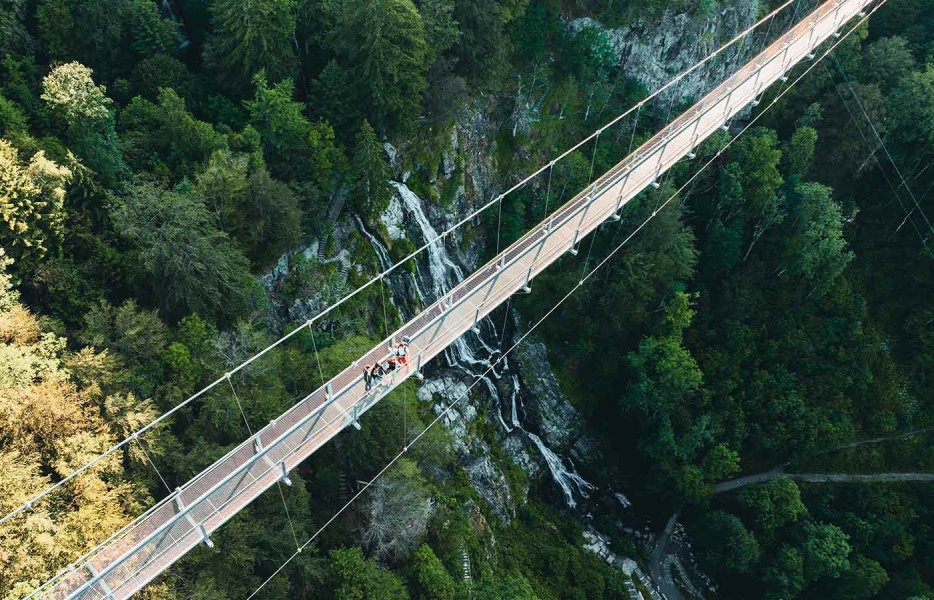
Directly above the waterfalls, the Blackforestline — a 450-metre suspension bridge — spans the valley at a height of 120 metres. A ticket for the bridge includes admission to the waterfalls. Nearby, the Fahler Wasserfall in the Todtnau-Fahl district is well worth a detour, plunging around 50 metres into the depths and free to visit. About 300 metres east of the upper cascade, you'll also find the Schatzstein, a monolith bearing mysterious inscriptions that have never been fully deciphered and are thought to be linked to the region's historic silver mining past.
Interesting facts
- The day pass at Todtnau Waterfalls is €2.50 making it one of the 3 cheapest tourist Attractions in Germany.
How to get there
By car
There are several car parks right next to the western entrance of the Blackforestline. Additional parking is available at the bottom of the hiking trail leading to the waterfall.
By public transport
The "Hangloch" bus stop is served by line 140 and is just under 200 metres from the western bridgehead. The "Aftersteg/Wasserfall" stop is also on line 140 and is located at the foot of the waterfall.