Contents
Route description
Up the Gitschberg with the cableway
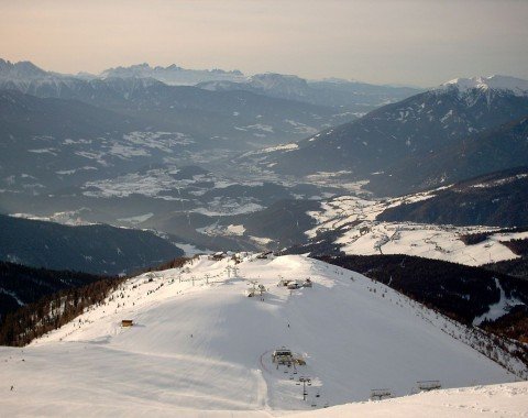
Once in Meransen, park your car by the valley station and take the cableway up to the top station of the mountain Gitschberg. Usually, the cableway operates from June to mid-October, ideal months for the tour described here. Furthermore, there are clearly marked signs on all the paths of the tour so that you will never feel lost. The hiking fun begins on top of the mountain in the direction of the Gitschhütte cottage. Prepare your cameras, the hike starts off with a great view down the valley while slowly leading its way uphill to the cottage. You will reach the managed cottage at 2211 m (7254 ft) and can rest by a great panorama-view with refreshing beverages and food here.
From the Ochsenboden to the Moserhütte
Whilst walking onto the Gitschhütte on trail marked with the number 20, keep hiking towards trail number 12 from here up until you reach the Zassler cottage. From now on the way to the Zassler Hütte is steadily downhill and you can get something to eat here as well. The cottage lies on 2050 m (6726 ft). Next, there will be an increase onto the Ochsenboden with trail number 21. Turn left on the junction with trail number 6 and hike up to the Moserhütte cottage which lies on 1939 m (6538 ft.)
Numerous places to get food
Here a newly constructed trail awaits you, which will lead your way by the mountainside over the Gassler Alm until the Bacherhütte. When with children, it is great to plan in a longer break at the Bacherhütte since there is a petting zoo belonging to the Bacherhütte cottage with all kinds of mountain animals located here. Continue your hike further on the trail marked with 19A while getting by the Kiener Alm and the Pichlerhütte. Especially the Pichlerhütte offers a phenomenal panorama-view where you can shoot great pictures to take home. Afterwards, return back in the direction of the Zessler Hütte but don't forget to take a sharp right in the direction of the mountain-restaurant Gitschberg on the way. You will be back at the starting point of the hike in no time from here, which is why you can enjoy a long break at the restaurant here to end your trip with a true culinary highlight.
Where to eat
The hike is especially notable because of the large range of places to get great things to eat on the way. There is absolutely no need to bring your own when you have that kind of options. For example there is the Gitschhütte right at the beginning with the Zassler Hütte coming afterwards. Then, after a short while you will furthermore get to cottages such as the Moserhütte or the mountain-restaurant Gitschberg as an absolute gastronomic highlight of the tour.
Interesting facts
- You're traveling a distance of 11 km on this moderate trail. Average length of all hikes in South Tyrol is 12 km.
- Alpine Pasture Circular Hiking Tour Maranza/Meransen is among the 10 best rated Hikes in Italy.
- You're facing an uphill climb of 278 vertical meters on this hike. The high point of the hike is located at an elevation of 2,242 m.
- Sturdy hiking boots are recommended on this track. If you get hungry along the way, there are places to rest and get food. Nevertheless it’s recommended to also have enough water and food in your backpack when hiking or biking.
Highlights of the tour

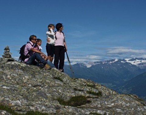
Since the tour leads your way along numerous cottages you will get the pleasure of seeing many of the traditional huts and cottages of South Tyrol from the inside. Be sure to check some of them out, every one of them has its special flair. The cottages are not only a great place to enjoy a refreshing beverage, but also invite their visitors to gaze at the magnificent view onto the Pfunderer mountains and down the valley. Especially notable is the Moserhütte cottage with its phenomenal panorama deck; it is ideal to shoot some great pictures here. Another highlight is the resting place Gampen where you can find artful wood carvings from South Tyrol.
Getting here
By car:
From Brixen:
Leave the city with the Via Brennero across Vahrn and Neustift Hiernach to reach the SS49 which you will follow to Bruneck. Leave the main street at the exit in the direction of Mühlbach/ Meransen and follow the road called Pustertaler Straße. Once in Mühlbach make sure to switch onto the Meranser Straße to get to the Lindenstraße and to the village called Steiner. With the Holzerweg and the Prockengasse streets you will lastly get to Meransen the starting point of the hike.
From Sterzing
Take the Brennerautobahn (A22) in the direction of Pustertal and leave the highway at the exit Bressanone/Val Pusteria/Brixen/Pusterta. Then drive in the SS49 and turn left onto the Pustertaler Straße to get to Mühlbach. Once in Mühlbach make sure to switch onto the Meranser Straße to get to the Lindenstraße and to the village called Steiner. With the Holzerweg and the Prockengasse streets you will lastly get to Meransen the starting point of the hike.
From Bruneck
Firtsly, take the SS49 to get to Mühlbach. Turn right onto the Pustertalerstraße to reach the city center. Make sure to switch onto the Meranser Straße here to get to the Lindenstraße and to the village called Steiner. With the Holzerweg and the Prockengasse streets you will lastly get to Meransen the starting point of the hike.
With public transportation:
It is also possible to reach Mühlbach with the train. From the station there are buses operating to the starting point of the hike, otherwise simply take the cableway right to Meransen.


