
Route description

Highlights from the start
This hike is moderate in its difficulty and starts off with a first highlight. You will find the panorama viewing platform near the starting point of the tour where you can gaze at the incredible landscape and nature all around you. Nevertheless, this doesn't mean that the rest of the hike would not be worth it – quite the contrary: The view on the valleys beneath you gets even better. Even though your tour starts off as high as 5824 ft (1775 m) the first part of paths will lead your way steadily uphill during the course of the hike. Therefore, take the so called “Confinweg” marked with trail-number 4 whereas you will pass the Zumisalm and reach the Ronerhütte at 6000 ft (1829 m) after the first couple of kilometers.
Up to the Astjoch
After a first possible rest at the Alp take the path marked with the number 2 over a forest-free mountain landscape in the direction of the Starkenfeldhütte. Next up switch paths to trail number 67 and hike along the mountainside, thus reaching the highest point of the hike after approximately 5 miles (8 km). You will reach the Astjoch on 7202 ft (2195 m) and will get your reward by the magnificent view onto the surrounding valleys of South Tyrol. Make sure to plan in an extensive rest, ideally at this very spot to enjoy the view for as long as possible.
Back to notorious ways
Afterwards the path will lead your way steadily downhill to the Einhäuserer Alm. There will be multiple paths crossing here, whereas you will take a sharp right turn and chose the path marked with the number 12. This will get you closer and closer back towards the valley until you find yourself by the Kreuzwiesenhütte on the foot of the mountain. Then take path 2A to reach the Steiner Alm from whereas you take a direct left and cross the Gfasebach stream. Finally, you will finish your round of hiking past the Grimmatze Alm befrore following the already known paths back towards the parking area Zumis.
Where to eat
During this hike you will find numerous places to rest and get something to eat or drink. Thus it is possible to eat at the Ronerhütte by the start or later on the hike for example at the Starkenfeldhütte. The Einhäuserer Alp is always a great place to take a break as well whilst enjoying culinary highlights from South Tyrol within the beautiful mountain landscape.
Interesting facts
- With an overall length of 19 km the hike is among the 10 longest hikes in Italy available on TouriSpo.
- You're facing an uphill climb of 494 vertical meters on this hike. The highest point of the track is 2,194 m above sea level.
- Make sure to bring sturdy footwear on this track. Hiking boots are highly recommended. If you get hungry along the way, there are places to rest and get food. Nevertheless it’s recommended to also have enough water and food in your backpack when hiking or biking.
Highlights of the tour
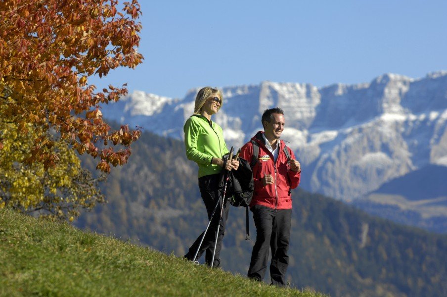
The magnificent surroundings of this tour make the hike very special. You will get an impressive view over the South Tyrol valleys right from the beginning and even better further on the trip up the mountainside. Not only the view of the Astjoch is a true thrill but also the long-lasting view onto the Alpenhautkamm. Make sure to gaze at the gorgeous views whilst enjoying the perfect mixture between challenging and fun during this sporty hike.
Variations
Of course you can always hike the roundly-part of this tour the other way around. Chose therefore the right trail at the junction behind the Grahalm Alp, hence not hiking towards the Starkenfeldhütte here.
Getting here
By car
From Sterzing
Take the Brennerautobahn from Sterzing for 14 miles (21 km) before leaving at the exit Bressanone/Val Pusteria/Brixen/Pustertal to continue on the SS49. Next, take the exit in the direction of Mühlbach and turn right on the Rodenecker Street shortly after. You will now be driving through San Benedetto where you follow the winding paths of the road and pass the shelter Rastnerhütte. Further along the road you will reach the parking area Zumis.
From Brixen
Leave Brixen with the Via Brennero and pass Vahrn and Neustift to get onto the SS49. Next, take the exit in the direction of Mühlbach and turn right on the Rodenecker Street shortly after. You will now be driving through San Benedetto where you follow the winding paths of the road and pass the shelter Rastnerhütte. Further along the road you will reach the parking area Zumis.
From Bruneck
Whilst driving on the SS49 you will get to Mühlbach after a few miles, where you turn left onto the Rodenecker Straße. You will now be driving through San Benedetto where you follow the winding paths of the road and pass the shelter Rastnerhütte. Further along the road you will reach the parking area Zumis.
With public transportation
You can also take the train to Mühlbach and switch into a bis here that gets you to the starting point of the hike in Zumis. Therefore, leave the bus at the “Rodenecker Alm” bus stop.
