
Route description
Start in the village Natz
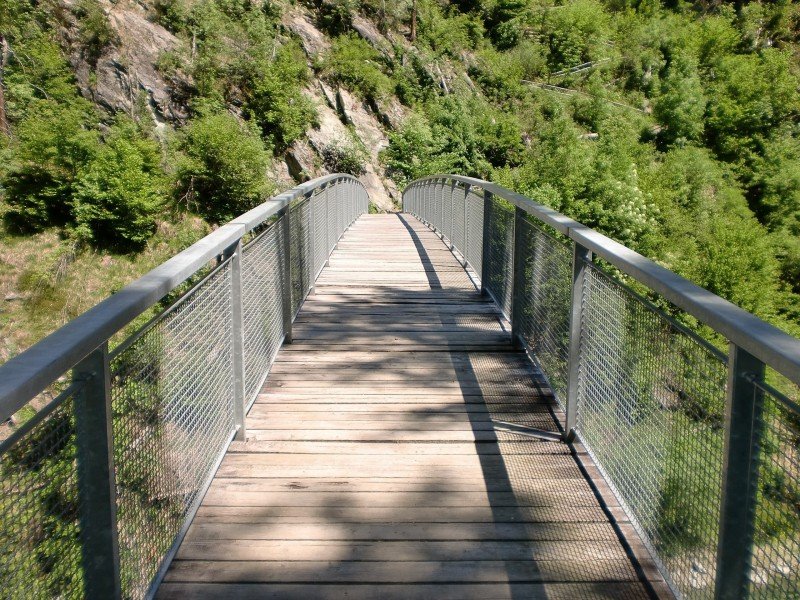
The city center of the village Natz is the starting point of this hike, from where you will firstly orientate yourself alongside trail number 4. This path runs via the Unterbrunnergasse out the village onto a fork, where you chose the left way and head uphill for a while until you reach the riverbank of the Rienz. Since you are walking through the valley, prepare yourself of hiking steep bits as well from there on trail number 4A behind the Rienz river. The path will lead your way through the forest almost in serpentines, until you reach the trail marked with trail-number 4 once again up on the mountain-crest. Trail number 4 turns into the so called Höfeweg (translated: Way of Farms) here.
Up to Rodenegg castle
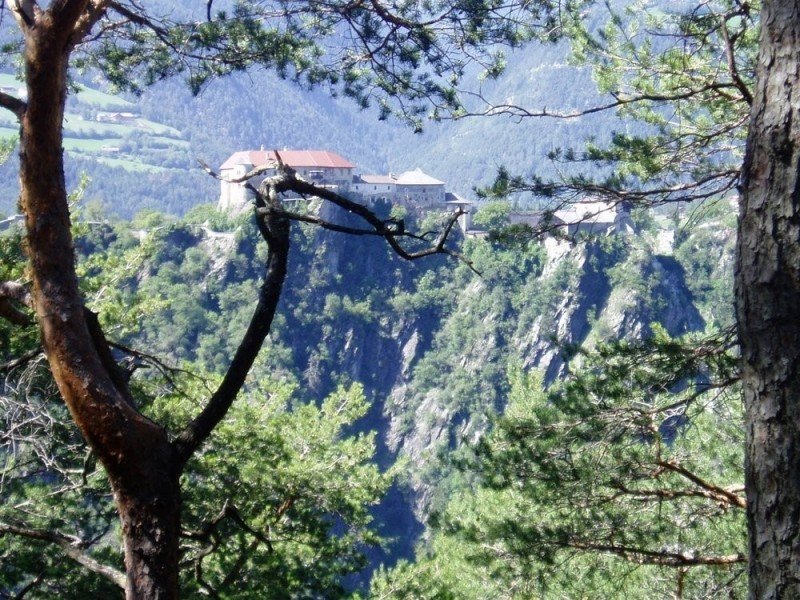
Follow the course of the theme path a little bit further up the hill and turn left onto trail number 1 at the next fork. Then, follow the path marked with trail-number 6 out of the forest to reach the Bienenweg (translated: “Way of the bees”) which will lead your way into the village Vill. Here you will once again meet path number 1 and a first highlight of the hike: The Rodenegg castle lies at this very spot on 875 meters and offers a great possibility for sightseeing of the castle to get to know the history of it and a great view down the valley.
Through a habitat back to the valley
After this cultural break the paths will lead your way back to the valley, where you will cross the river Rienz. Continue hiking on trail number 1 and follow its course first through Viumes and then through the habitat Sommersürs, that offers a magnificent range of plant and animal species. Last but not least, hike on the same path back to the starting point in Natz.
Where to eat
Since you are hiking through numerous villages there shouldn't be any kind of problem when it comes to searching for a place to eat.
Interesting facts
- You're traveling a distance of 14 km on this moderate trail. Average length of all hikes in South Tyrol is 12 km.
- You're facing an uphill climb of 721 vertical meters on this hike. The high point of the hike is located at an elevation of 990 m.
- Sturdy hiking boots are recommended on this track. If you get hungry along the way, there are places to rest and get food. Nevertheless it’s recommended to also have enough water and food in your backpack when hiking or biking.
Highlights of the tour
The hike is especially known for its variety. This is no where near a boring one-way track, it is an exciting hike through valleys and woods, up mountain-crests and by pastures. The different landscapes here are fascinating, be it because of wild gorges or high plateaus which you will meet on the course. You will get to see so many highlights of nature in just one day on this 14 kilometer long hike.
You will also reach Rodenegg castle during this hike, where you should make sure to take a break to give this venue a closer look. The castle was constructed in the Middle Ages and had many different owners over the centuries until becoming a home to the family of Oswald von Wolkenstein in the 16th century, who was a very famous musician and singer during that time. The building is especially notable because of its historic murals, the castle chapel and its fancy garden
The hike has many highlights of nature to offer during its course as well. Most of them will be found in the Sommersürs habitat, which exists for over 40 years now and is a true benefit for the entire region. Equally impressing is the Rienz gorge, where you will be hiking a big part of the tour. You will be able to enjoy a magnificent view onto the steep hillsides and the riverbed with the green spark of the Rienz water.
Getting here
By car
From Sterzing
You will reach the starting point of the hike in only a few minutes from Sterzing. Therfore, take the Brennerautobahn (A22) for about 21 kilometers until reaching the exit in the direction Brixen/ Pustertal and heading onto the SS49 to the village Natz.
From Bruneck
Leave Bruneck in the direction of Sennenburg and continue on the SS49. Follow the signs in the direction of Natz-Schabs and follow the course of the road until reaching the equally named village.
From Bozen
Leave the city with the SS12 and head onto the Brennerautobahn (A22) which you follow for the next 39 kilometers. Following that take the exit in the direction of Brixen/ Pustertal and take the SS49 until reaching the village Natz.
There are numerous possibilities for parking in the city center of Natz.
With public transportation
Take the train from Bozen to Fortezza and take a taxi from there or alternatively walk the 6 kilometers to the starting point of the hike.