

Route description
Böhmweg trail is almost 50km/31mi long. The centuries-old connection between the Danube and Bohemia used to be the most important trade route in the Bavarian Forest. Nowadays, it is a popular hiking trail.
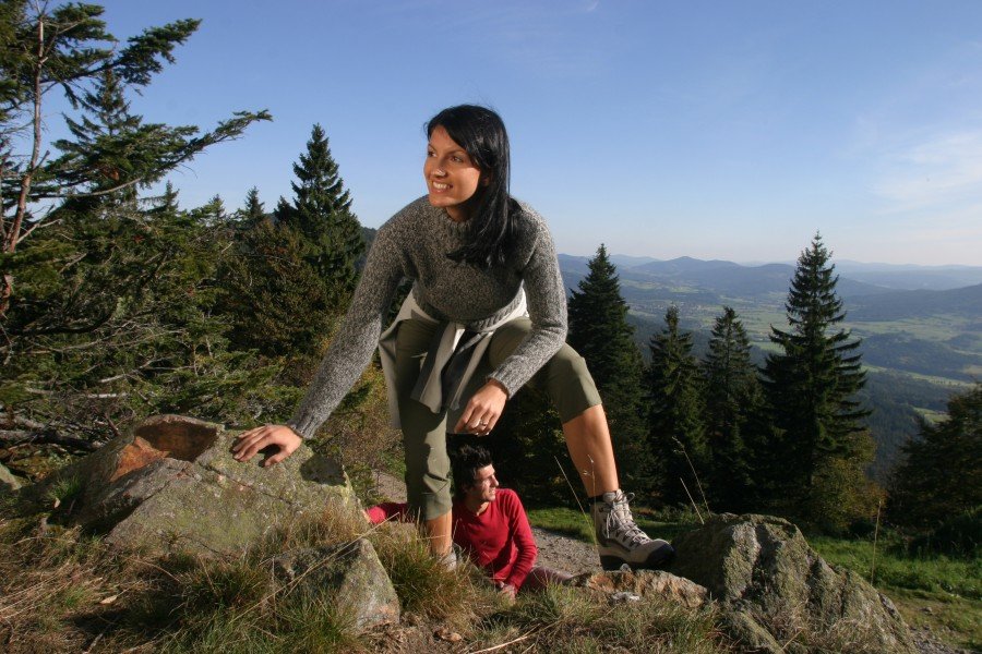
Due to partly considerable vertical drops, it is recommended to spread the hike over four days, which leaves you with relatively short day stages on usually walkable and broad paths. Hence, Böhmweg is the perfect destination for a short family getaway. Furthermore, it gives you the opportunity to really enjoy the several stages, and combine your hike with local sights.
Day 1: Deggendorf - Bischofsmais (17km/10.6mi)
From Deggendorf, we recommend to take a bus to Maxhofen at first (around 10 minutes) to start the hike from there. The first stage startes across from the bus stop. It leads you out of the Danube plane and over stony hiking paths into the Bavarian Forest to Josephsbuche (480m/1,575ft). You walk past the pilgrimage church in Greising, and get to enjoy the great view over the Danube plane. You descend back down through woodlands towards Bischofsmais until you reach the pilgrimage church St. Hermann. You can either pass the church and go straight to Bischofsmais centre, or walk along a field trail past the north-west side of the town and along historic embankments.
Day 2: Bischofsmais - Weißenstein (7km/4.3mi)
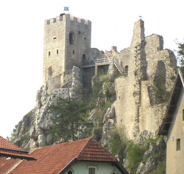
From Bischofsmais, hike down to Fahrnbach stream on meadow and forest lanes, and then towards the town of the same name. Keep following the hiking trail down to the valley of Schlossauer Ohe. Here you are looking at a relatively steep ascent (around 180m/591ft) to the town of Weißenstein and the impressive Weißenstein Castle ruins. Enjoy the view over the mountains of the Bavarian Forest from the castle tower. You have reached today's destination, and should have plenty of time to explore the surroundings. For example, you can visit the glass forest, right next to the castle ruins. Other activities include a visit of the city Regen, a walk through the nature reserve, or a visit of the museum at 'Fressendes Haus'.
Day 3: Weißenstein - Zwiesel (12km/7.5mi)
From Weißenstein, you continue on gravel paths and small country roads through Poschetsried and the valley of Rinchnacher Ohe to Rinchnachmündt and Schweinshütt. From the small town with its imposing church, the trail goes on to the glass town Zwiesel. If you prefer asphalted roads to narrow hike trails, you can alternatively walk through the city of Regen and along the river through Regen valley to Zwiesel. As this leg of the hike features hardly any gradients, you should get to your destination relatively timely, which leaves you the opportunity to visit Zwiesel with its cultural highlights. The catholic church as well as the forest museum are definitely worth a visit. If you want to learn more about glass production, an important industry in the Bavarian Forest, you should visit the glass museum Theresienthal, or one of the glass huts.
Day 4: Zwiesel - Bayerisch Eisenstein (16km/9.9mi)
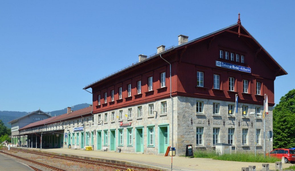
The last stage of the hike is characterised by constant up and downs. From Zwiesel and Glaspark Theresienthal, continue to the town of Glashäuser, and then follow a stony forest trail towards Ludwigsthal. Böhmweg leads along railway tracks and past the town to Zwieslerwaldhaus, where you can visit the oldest glass site in the Bavarian Forest. From here, it is but a short way to the Bavarian-Bohemian border, and the small crossing place near Ferdinandsthal, which is oben from 6 am to 10 pm from April to September, and from 8 am to 6 pm in the winter. Beautiful forest paths lead through Šumava National Park to Železná Ruda. From there, you are only a few steps away from the train station in Bayerisch Eisenstein, which is where the tour ends.
Where to eat
- Greisinger Hof on the first stage.
- Ritterschänke zur Weißensteiner Alm features a range of hearty meals in a medieval atmosphere.
- Gasthaus zum Wurzelsepp inside a former school building is a traditional pub that also boasts a beergarden and a sun deck.
- Zwieseler Waldhaus is the oldest pub in the Bavarian Forest, dating back to 1764.
- Gasthaus Stückl
- Dorfgasthaus - Pension Bärnloch
- You can find several cafés and restaurants in Zwiesel and Lindberg
Interesting facts
- With an overall length of 47 km the hike is among the 10 longest hikes in Bavaria available on TouriSpo.
- Böhmweg Trail is among the 10 best rated Hikes in Bavaria.
- You're facing an uphill climb of 1575 vertical meters on this hike. This makes the hike one of the 10 hikes with the most ascent in Bavaria. The hike takes you to an elevation of 936 m.
- The hike is one of the family friendly trails in the region.
- You shouldn’t forget to bring your hiking boots. There are some sections on the trail where sturdy footwear is required. If you get hungry along the way, there are places to rest and get food. Nevertheless it’s recommended to also have enough water and food in your backpack when hiking or biking.
Highlights of the tour
- Pilgrimage church in Greising
- Pilgrimage church St. Herrmann and Bischofsmais
- Weißenstein Castle ruins
- Museum at 'fressendes Haus'
- Forest museum Zwiesel
- Glass museum Theresienthal
Variations
If you don't want to cross the border on the last day, you can go straight to Bayerisch Eisenstein on the long-distance hiking trail E6 through a natural reserve.
Getting here
By car:
From motorway A3, take exit Deggendorf-Mitte and follow B11/E53 to the centre. After around 5 minutes, turn left at the park into Stadtfeldstraße, which leads you straight to the train station, where the hike starts.
Public transportation:
To avoid parking fees for four days, you can use the public transportation services to get to Deggendorf. Waldbahn trains go between Plattling, Deggendorf, and Bayerisch Eisenstein on an hourly basis. Numerous train lines from other places call in Plattling.