Route description
Via Witikosteig to Dreisessel
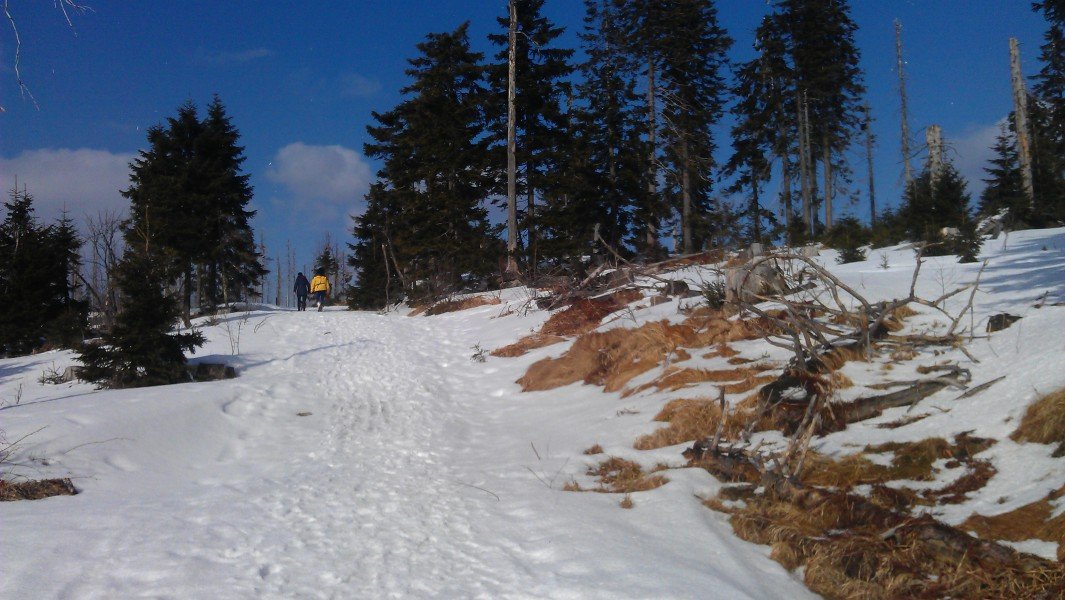
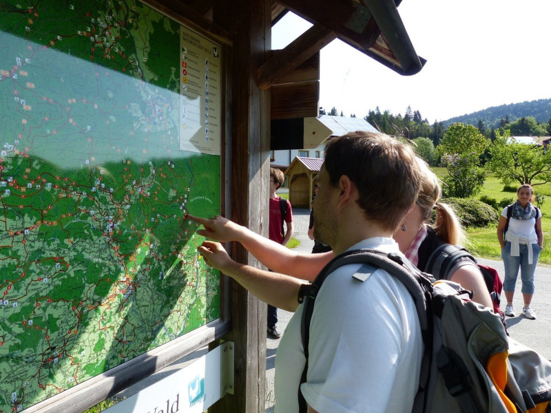
The tour starts at Rosenberger Gut, a popular mountain restaurant above Lackenhäuser. A large hiking board at the car park shows you all the trails on Dreisessen mountain. The path first leads steeply upwards, on relatively wide forest trails. At the lower bit of the hike, the woods are still quite dense, and provide some shade. You should find your way easily, as you only have to follow the signs pointing to Dreisessel. After around 30 minutes, Witikosteig crosses the old border road, 'Alte Ewigkeit' (eng. old eternity), and leads you to the asphalted flyover on a narrow path. Turn right onto the flyover and follow the road to the peak of Dreisessel.
Dreisessel Rocks, Hochstein, and Nepomuk Chapel
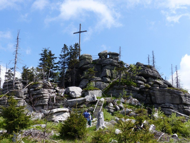
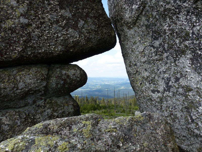
Once you have reached the summit, you should definitely climb up the Dreisessel Rocks, accessible via steep stone stairs. The 20m/66ft high granite formations are what gives the Dreisessel massif its name (Dreisessel = three chairs), as there are three stone seat pans on the rocks. It is yet unknown, how and when they came to be.
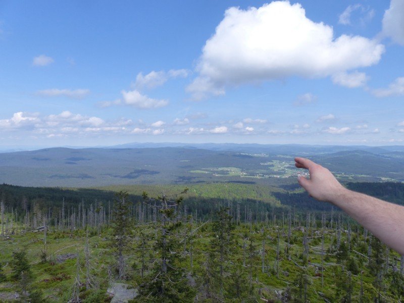
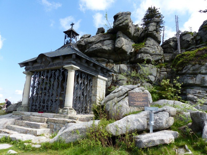
The summit cross is located 1,332m/4370f above sea level, on Hochstein rock. To get there, pass the inn Dreisessel Berggasthof eastbound. You will find the massive granite rock, and the beautiful Nepomuk chapel after around 300m/985ft. From the summit cross you have a great view over the Bohemian Forest in the East, the Bavarian Forest National Park with the two peaks of Lusen and Rachel in the north, and the Danube valley with the Berchtesgaden Alps in the background in the south.
Way Back via Hochkammweg, Trijunction, and Steinernes Meer
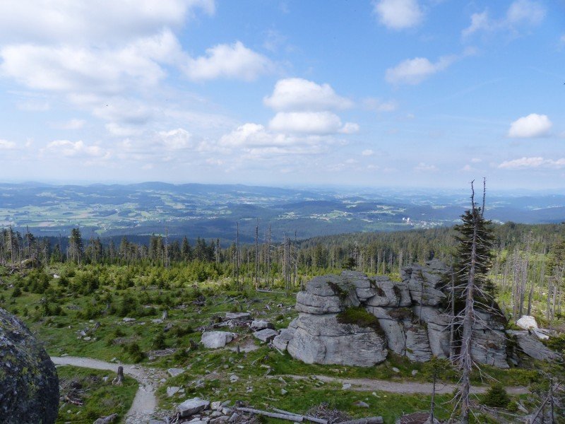
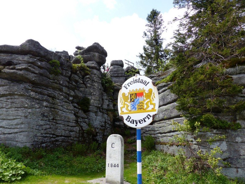
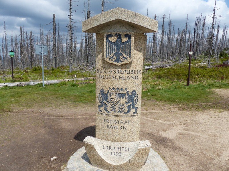
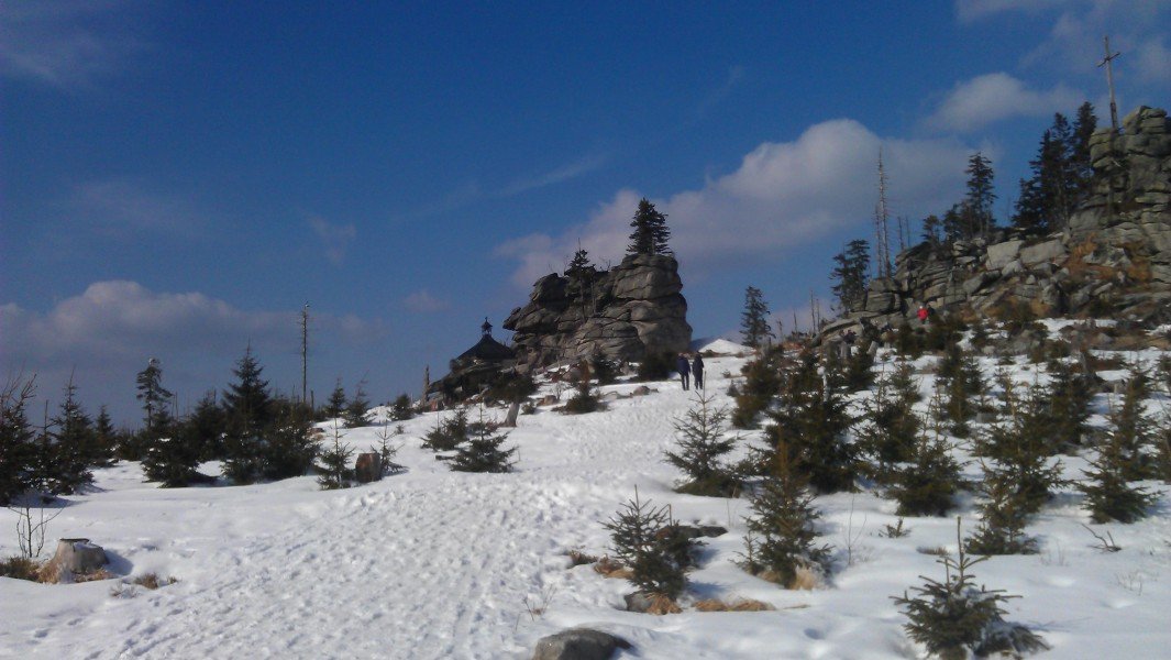
Follow the signs posting to Plöckenstein Dreiländereck, in order not to have to go down the same way you came. The so-called Hochkammweg goes quite planely south along the ridge of the Dreisessel massif. You reach the trijunction after a 45 minutes' walk. It is marked with a large stone pillar with Bohemian, Bavarian, and Austrian crests. Hochkammweg is one of the nicest sections of the hike, as the sparse forest opens up beautiful views as far as to the Alps. You can take a break at the trijunction before following the signs to 'Steinernes Meer'. Literally 'rocky sea', the Steinernes Meer is a collection of large rocks that emerged during the ice age. You can sit on the rocks and enjoy a last view over the southernmost hills of the Bavarian Forest and the Danube valley.
For the last leg of the journey, cross the flyover again to get back to Witikosteig. Turn left towards Lackenhäuser until you get back to the car park above Rosenberger Gut.
Where to eat

- Berggasthof Dreisessel mountain inn features affordable dishes and a sun deck right at Dreisessel peak.
- Gasthaus Rosenberger Gut has high-brow local cuisine and is located at the start and destination of the hike. It features a beautiful beergarden.
Interesting facts
- You're traveling a distance of 13 km on this easy trail. Average length of all hikes in Bavaria is 49 km.
- You're facing an uphill climb of 1093 vertical meters on this hike. The high point of the hike is located at an elevation of 1,366 m.
- This easy hike is perfect for the whole family. The hike is also perfect if the kid’s wanna bring their dog on the trip. (See all dog friendly hikes in Bavaria.)
- Sturdy hiking boots are recommended on this track. If you get hungry along the way, there are places to rest and get food. Nevertheless it’s recommended to also have enough water and food in your backpack when hiking or biking.
Video
Highlights of the tour
The dead forest (trees harmed by bark beetles in the highlands of the Bavarian Forest) along Hochkammweg allows for a beautiful panorama over the Bohemian Forest in the east, and the Danube valley in the west.
Variations
You can prolong the hike for about 3 hours, if you descend to Lake Plöckensteinsee at the trijunction.
Equipment
- sturdy shoes
- sufficient water
Getting here
From motorway A3
Exit motorway A3 Nürnberg - Passau at Aicha vorm Wald towards Hutthurm/Waldkirchen/Freyung. After about 17km/10.6mi, turn left onto B12 towards Waldkirchen. After another 7km/4.3mi, turn right and follow the signs towards Waldkirchen. Continue until Neureichenau/Lackenhäuser.
From Passau
From Passau, simply follow B12 towards Freyung until you reach the turnoff to Waldkirchen, and go on until Neureichenau and Lackenhäuser.