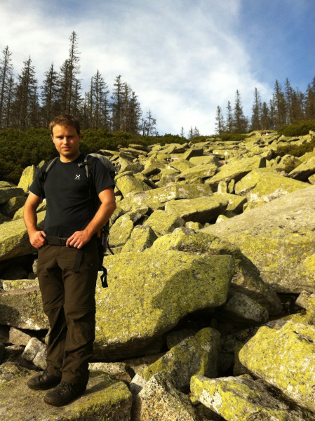
Route description
Over Dreisessel to Plöckenstein
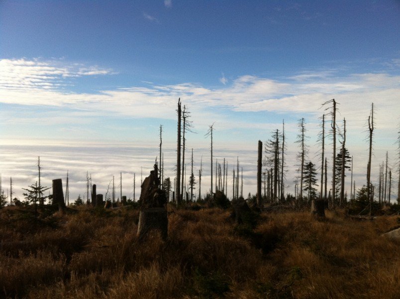
The Dreisessel massif is one of the southernmost mountain ridges of the Bavarian Forest. We start the tour at almost 1,300m/4,265ft above sea level. Hence, the path starts planely towards Plöckenstein. However, do not underestimate this tour. Geting back up from Plöckensteinsee lake later will definitely get your heart rate going.
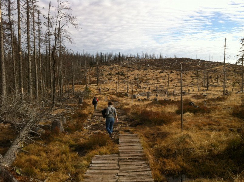
From the car park, walk along the paved road up towards Dreisessel, but turn right towards the inn befor the last steep bit. Now follow the mountain ridge through the typical dead forest of the Bavarian Forest, presenting us with beautiful views of the Danube valley in the south west as well as all the way to the Alps when the conditions are good. Continue to the trijunction Bavaria-Bohemia-Austria. A large polished stone with crests of all three countries helps you find the way. Now, continue a bit further uphill to the small hut on Plöckenstein/Plechý mountain.
On to Plöckenstein Lake
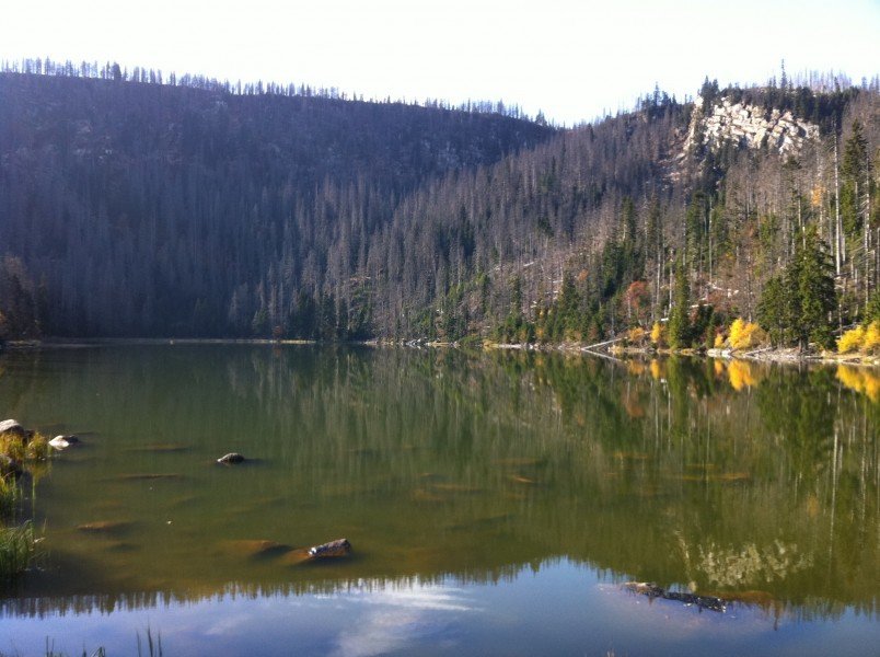
Plöckenstein became famous in Germany thanks to Adalbert Stifter who wrote adoringly about the high forest in Bohemia in the 19th century. At 1,367m/4,485ft above sea level, it is the highest mountain in South Bohemia. The towns on both the Bohemian and the Austrian side have dedicated a big stone obelisk as a memorial to him. It is definitely worth talking a rest here to enjoy the view over the lake and the glacier wall behind it. Today, it is hard to imagine, that a glacier created the scarp during the last ice age. Plöckenstein lake is the southernmost of eight glacier lakes that can be found at the German-Czech border mountains.
From the Adalbert Stifter memorial on, the path keeps getting more and more narrow, the descent gets rocky, and demands a safe step. At the lake you can find some benches and tables to rest and eat.
Overcoming the Glacier Wall
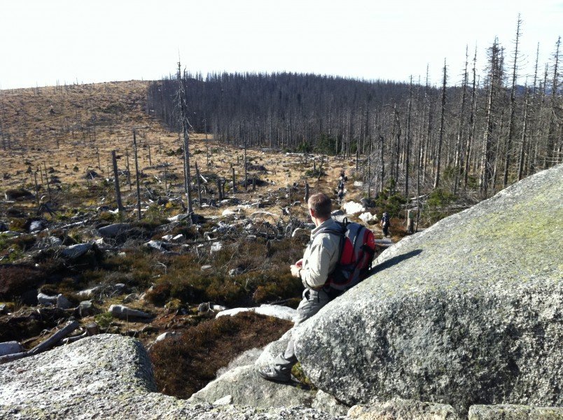
After your rest at the lake, the demanding part of the hike starts: the ascent back to Plöckenstein over the lake's south-east bank. Just follow the way along the lake, leading you past beautiful rock formations, until you reach a junction where you follow the steep trail to the right. The ascent is quite challenging, but offers beautiful views of the lake and the Bavarian Forest in return. From the summit you walk back to the trijunction the way you came.
Back to the Inn via Steinernes Meer on Dreisessel
If you are tired already, you can go straight back to the mountain inn Berggasthof Dreisessel. For this hike, we follow the slightly longer way to pass Steinernes Meer (signposted from the trijunction). It is located at the west face of Dreisessel, and can be seen from afar. Large rocks dating back to the ice age are a nice place to sit and enjoy a last view of the southernmost hills of the Bavarian Forest and towards the Danube valley. After Steinernes Meer, follow the way until you get back to Berggasthof Dreisessel.
Where to eat
Berggasthof Dreisessel is usually open every day. Opening hours vary, and can be found online.
Interesting facts
- You're traveling a distance of 15 km on this moderate trail. The average length of all hikes in Bavaria is 49 km.
- Lake Plöckenstein via Mountain Hut Dreisesselhaus - Bohemian Forest is among the 10 best rated Hikes in Germany.
- You're facing an uphill climb of 761 vertical meters on this hike. The hike takes you to an elevation of 1,374 m.
- The hike is one of the family friendly trails in the region. What’s even better: You can also bring the family’s best friend on this dog friendly hike. (See all dog friendly hikes in Bavaria.)
- You shouldn’t forget to bring your hiking boots. There are some sections on the trail where sturdy footwear is required. There are places to buy beverages and food along the track. However it’s always recommended to bring enough water and food along with you.
Video
Highlights of the tour
- View towards the Alps (only in good conditions)
- Adalbert Stifter memorial
- View over Plöckenstein lake
Variations
Instead of going to the trijunction, you can go straight to Steinernes Meer, making the hike considerably shorter.
Equipment
Sturdy shoes are absolutely recommended for the descent to the lake. Furthermore, you should bring enough water and maybe something to eat, as Berggasthof Dreisessel at the end of the hike is the only possibility to eat something.
Getting here
By Car to Altreichenau
To get to Altreichenau by car, you should take the way through Waldkirchen and Jandelsbrunn. From there, Altreichenau is signposted. Coming from Passau, B12 is the fastest route. If you travel on motorway A3, exit at Aicha vorm Wald.
To the Starting Point of the Hike
You can get to Berggasthof Dreisessel from Altreichenau in a 10 minutes' drive. Drive towards Haidmühle. Around Frauenberg, just after the base station of the ski lift, follow the signs to Dreisessel to the right. Now just follow tohe road until it ends in a car park. Here is where the tour starts.