
Route description
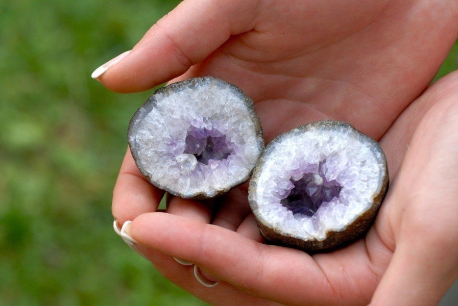
Museum of Minerals in Teis
The starting point of this hike is in Teis, where you will find the first highlight of your tour. In the village of Teis there is a Museum of Minerals, which is definitely worth your visit. After a visit in the museum leave the small village walking on a solid road at first. Once you see a small hiking trail marked with the number 11 change onto that one and keep on hiking. The first part of your hike will be through forested area and you will have to prepare for some steeper hiking uphill. After you have managed the passage through the woods, you will get to relax a little because the next trail leads you through small villages around Miglanz and Petruder. Keep hiking on path number 11 until you reach St. Valentin church.
Traversing the Sunnseitenweg path
After a quick stop visiting the beautiful church, you will now find yourself at a crossroad. Keep left and start hiking on Sunnseitenweg. Follow this hike for a couple of yards until you get to an intersection with the main street right around St. Jakob church. Take a left here and follow the hiking trail marked with the number 30. Traverse the Melanserbach creek and keep hiking on the previously mentioned trail. Very soon you will reach another crossroad where you take two left turns. You should be on trail number 30 A and do a sort of circular-hike around the Hauben. Keep walking on the trail until you reach your starting point in Teis.
Where to eat
Before and after your hike you will be able to stop to eat, drink and rest in Teis. On your actual tour you will find a place to grab a bite to eat in Moar. Besides those two options there are no other possible rest-stops because the trail leads you mostly through smaller villages and forested area.
Interesting facts
- You're traveling a distance of 11 km on this moderate trail. Average length of all hikes in South Tyrol is 12 km.
- You're facing an uphill climb of 430 vertical meters on this hike. The hike takes you to an elevation of 1,355 m.
- You shouldn’t forget to bring your hiking boots. There are some sections on the trail where sturdy footwear is required. If you get hungry along the way, there are places to rest and get food. Nevertheless it’s recommended to also have enough water and food in your backpack when hiking or biking.
Highlights of the tour
Before you start your actual tour, you should definitely visit the Museum of Minerals in Teis. You are able to see the collection of minerals of Paul Fischnaller, who is a big collector in the field. Besides local exhibit pieces you will find rocks and stones out of the area around Mont Blanc or from Switzerland. When hiking with kids you will find the museum as an interesting starting point to get your kids all excited for the tour.
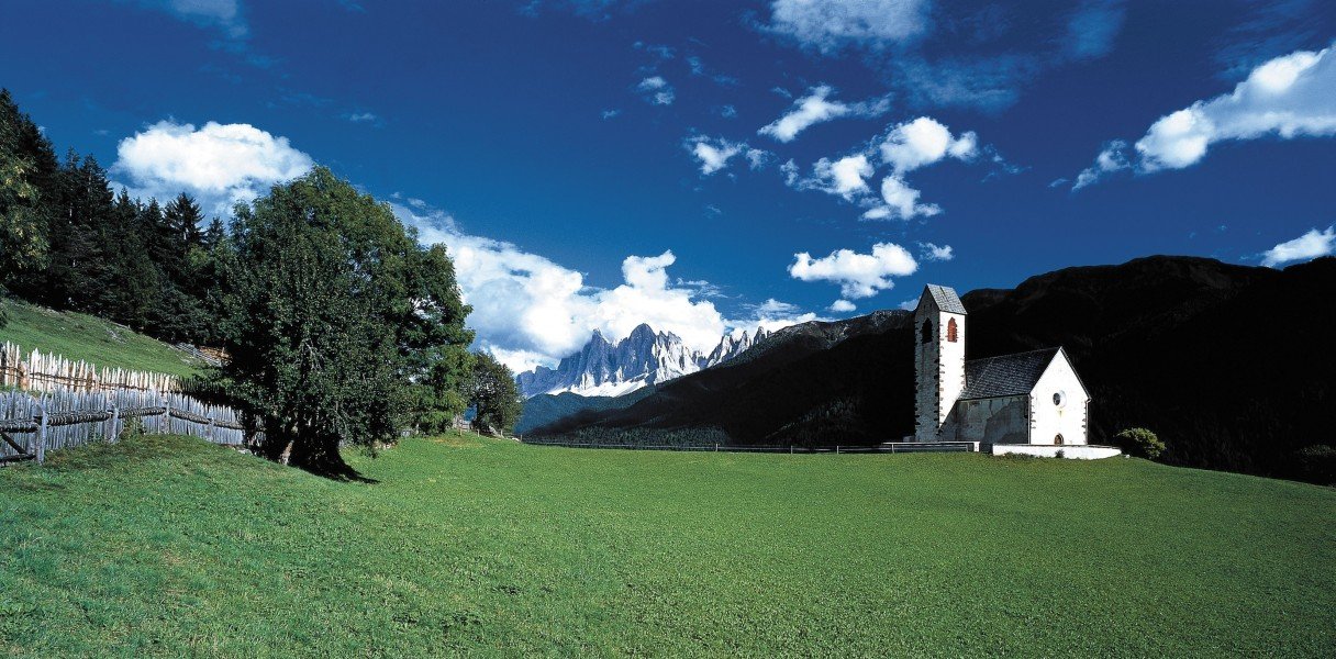
On the tour you will see a lot of churches. You should not just walk past them but get a closer look of the inside. The St. Valentin church for example has impressive carvings in the altar and is known for its amazing wall paintings. The St. Jakob church should also be a stop on your route because being surrounded by a semi-circular stone arch it is a fascinating and rather unusual building. On the inside you can admire the altar in Gothic style, which was manufactured in 1517. The architecture in all of the churches is extraordinarily beautiful and the few sights on your tour invite you to make a quick stop, catch your breath and enjoy the landscapes around you. The tour is with all its sights and special features a diverse and fun route for hikers of all ages.
Getting here
By car
Starting in Sterzing
Drive onto the Brennerautobahn (highway) A22 and follow the road for the next 31 kilometers (19.3 mi). Take the exit in the direction of Brixen and change onto the SS12. Keep left and follow the signs in the direction of Teis. In Meles you need to take a sharp left to get to the starting point of your hike.
Starting in Bozen
Drive onto the SS12 and follow the road for four kilometers (2.5 mi). The main street will take you to the ramp of the Brennerautobahn (highway) A22 and you have to follow that road for 24 kilometers (15 mi). Take the exit at Klausen-Gröden and take the first exit at the roundabout. Keep driving in the direction of Meles, take a sharp left turn and you should reach the starting point of your hike in Teis.
On site you will find numerous parking possibilities.
By public transportation
Starting in Klausen there is a bus leaving to Teis regularly.