in the Bavarian Forest: Position on map")
Route description
From Kreuzbachklause to Hochstein
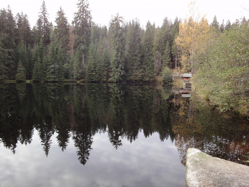
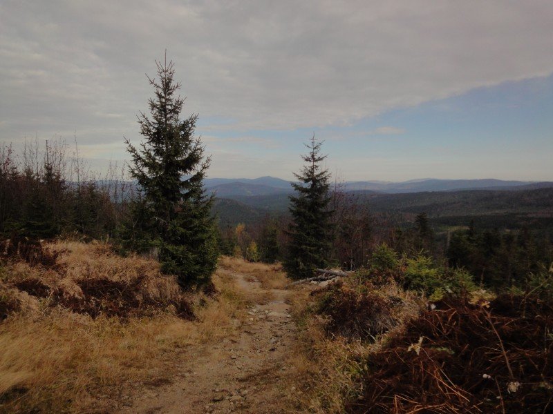
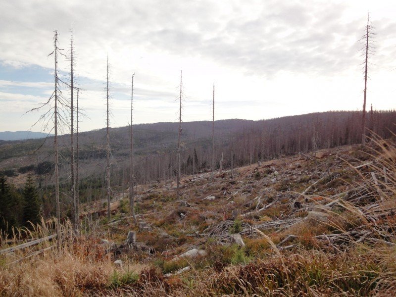
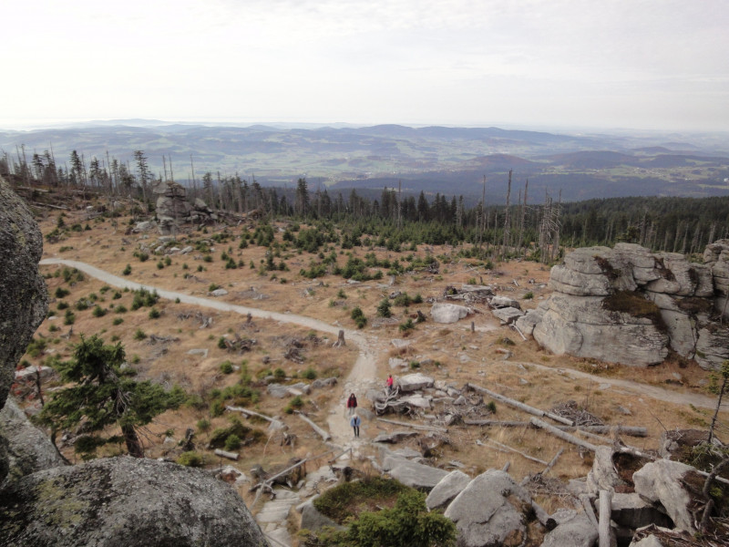
The hike first passes Kreuzbachklause, a former drift lake. The lake used to serve as a means of getting wood from the Bavarian Forest onto Osterbach and Ilz rivers and all the way to Passau. The path ascends moderately at first, and leads through dense forest. Later, the woods get much more sparse. Many trees in the highlands of the Bavarian Forest have been severely harmed by the bark beetle, and consequently died. This 'Dead Forest' characterises the hike in the upper parts. Due to the lack of trees, you get beautiful views of the Bohemian Forest as far as the Czech town Prachatice.
Alp View from Dreisessel Mountain
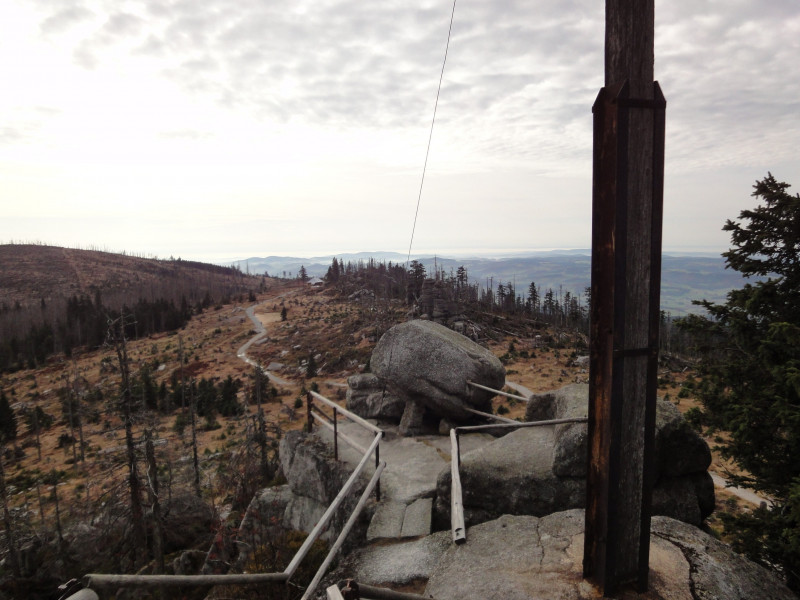
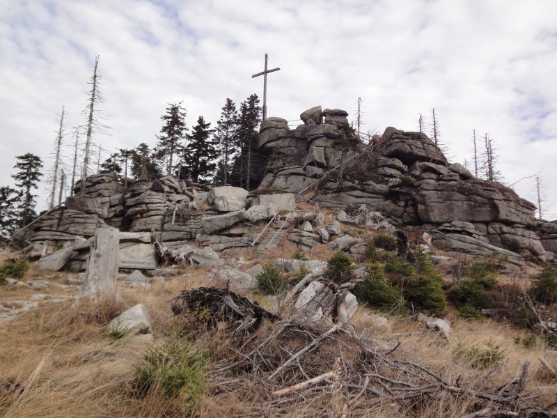
Dreisessel Mountain is the southernmost crest of the Bavarian Forest. This hike leads us to the 1,333m/4,373ft high Hochstein. Its peak is hard to miss. After the last, rather steep passage you can see massive blocks of granite at the peak. A wooden cross marks Hochstein's summit. On the west face of the granite block you can find the chapel of Johann Nepomuk Neumann, a beautiful stone chapel built in 1979, in honour of Bishop Johann Nepomuk Neumann's canonisation. It often serves as a place to rest for hikers, but masses are often still held here on Sundays. From the chapel as well as from Hochstein summit, you get a great view all the way to the Berchtesgaden Alps when there is foehn wind.
Way Back to Kreuzbachklause
For the way back we chose the north face for this hike. Just follow the signs pointing north from the chapel. The way descends steeply, until you cross a forest path. Follow that path for around 1.5km/0.93mi to the right until you find the signs pointing back to Kreuzbachklause.
Where to eat
To grab a bite to eat, you can go to the mountain inn Berggasthof Dreisessel, a little bit south of the Nepomuk chapel. For a reasonable price you can have your food served at the cosy pub or on the sun deck.
Interesting facts
- You're traveling a distance of 9 km on this easy trail. The hike is therefore not too long. Average length of all hikes in Bavaria is 49 km.
- You're facing an uphill climb of 815 vertical meters on this hike. The highest point of the track is 1,340 m above sea level.
- Don’t hesitate to take your kids along on this easy hikes. The hike is also perfect if the kid’s wanna bring their dog on the trip. (See all dog friendly hikes in Bavaria.)
- Make sure to bring sturdy footwear on this track. Hiking boots are highly recommended. If you get hungry along the way, there are places to rest and get food. Nevertheless it’s recommended to also have enough water and food in your backpack when hiking or biking.
Video
Highlights of the tour
The 'Dead Forest' in the highlands of the Bavarian Forest is unique in Europe. The bare trees don't only make for an eerie atmosphere, but also grant beautiful views into the Bohemian Forest to the east and over the Danube valley towards the west.
Variations
Dreisessel is a mountain massif of almost 20km/12,5mi. From Berggasthof Dreisessel, numerous hiking trails lead towards Plöckenstein. Hence, you can prolong the hike to your own taste.
Getting here
To Altreichenau by Car
To get to Altreichenau by car, you should drive via Waldkirchen and Jandelsbrunn. Altreichenau is signposted from there. Coming from Passau, B12 is the quickest road to Waldkirchen. If you travel on motorway A3, exit at Aicha vorm Wald.
To the Starting Point
To get to Kreuzbachklause, drive towards Haidmühle from Altreichenau. Around Frauenberg, just after the ski lift's base station, follow the signs towards 'Dreisessel' to the right. After around 2km/1.2mi you will find the car park at Kreuzbachklause, which is where this hike begins.