Route description
Start the hike at the car park, walk through the stations and towards alp Aule-Alm. Continue through the woods to lake Riessersee. Keep right and get to the historic bobsleigh run. Make a stop at the bobsleigh museum. Thursdays guided tours are for free between 2 pm and 4 pm.
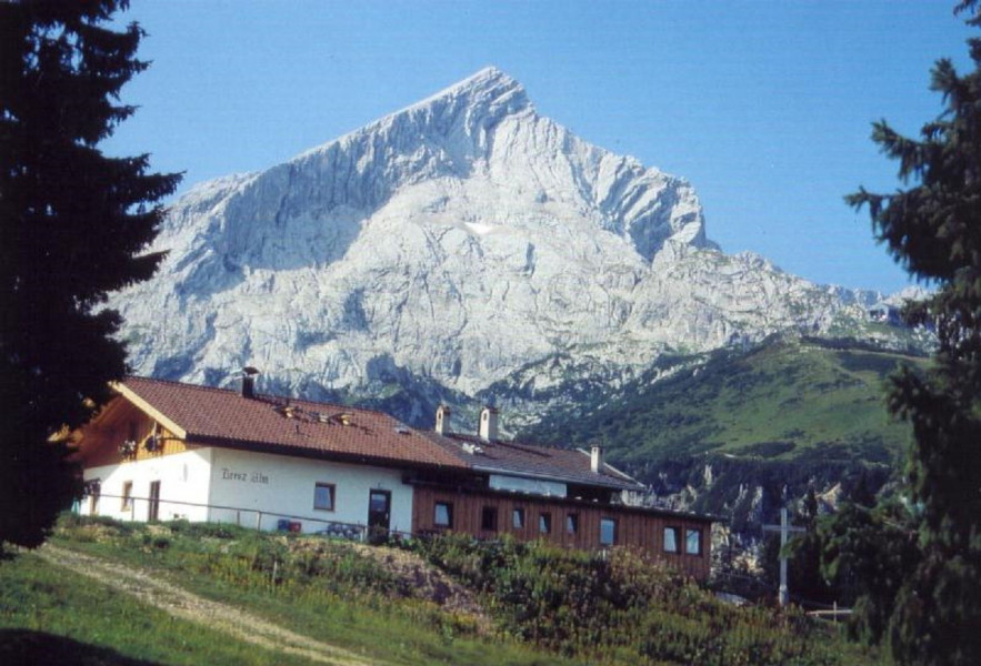
Afterwards, hike up the former bobsleigh run. The trail there will be half forest road half forest path. You will reach the mountain hut Tonihütte or Riesserkophütte. Pass the hut on the right, follow the forest road for a while longer and then turn left into the woods. Follow the forest path, which will lead to the shut down mountain hut Tröglhütte. From there, follow the signs towards 'Kreuzeck'. You will reach 'Hexenkessel' and after approximately 25 min via alp Kreuzalm you will get to the guest-house Kreuzeckhaus, up on the peak.
Stay overnight at Kreuzeckhaus and explore many more hikes starting there.
Interesting facts
- You're traveling a distance of 16 km on this strenuous trail. Average length of all hikes in Bavaria is 49 km.
- Elevated between 754 m and 1,623 m, the hike is among the 10 highest elevated hikes in Germany. You're facing an uphill climb of 1830 vertical meters on this hike. This is quite much. You should be fit to do this track. This makes the hike one of the 15 hikes with the most ascent in Germany.
- Sturdy hiking boots are recommended on this track. If you get hungry along the way, there are places to rest and get food. Nevertheless it’s recommended to also have enough water and food in your backpack when hiking or biking.
Equipment
You will need ankle-high hiking boots and you should not be afraid of hights and be sure-footed.
Getting here
By car
Take motorway A95 from Munich to Garmisch-Partenkirchen. Change in Eschenlohe from Autobahn to national road B2 towards Garmisch-Partenkirchen. Follow the signs past tunnel Farchanter.
Drive through Garmisch and continue towards Grainau/Zugspitze and towards Kreuzeckbahn/Alpspitzbahn. Passed the barracks turn left and get right to the station at the bottom of the ropeway.
From Innsbruck/Mittenwald take B2 until the crossing in Partenkirchen and turn left towards Grainau/Zugspitze/Fernpass/Reutte. Afterwards follow the signs Kreuzeckbahn/Alpspitzbahn. Then turn left and get directly to the station at the bottom of the ropeway.
From Ehrwald/Tirol and Grainau/Zugspitze take B23. Arriving Garmisch-Partenkirchen turn right at the traffic light shortly before the barracks. Then follow the signs Kreuzeckbahn/Alpspitzbahn and get directly to the parking lots.
Parking P9