
Description
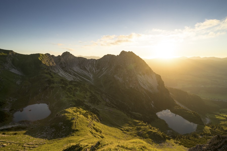
Tucked away behind the striking Rubihorn peak above Oberstdorf, the lower and upper Gaisalp lakes are nestled like sparkling gems in the rugged high-alpine landscape. Formed during the last Ice Age, these two glacial cirque lakes (known as Karseen in German) are among the most scenic natural spots in the southern Allgäu.
The Lower Gaisalp Lake
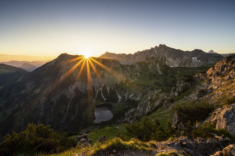
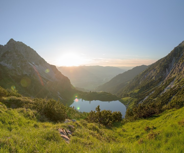
Sitting at an elevation of 1,508 meters, the larger of the two lakes rests in a natural cirque basin. It spans 3.5 hectares and is fed by the Gaisalpbach stream, which eventually flows into the Iller River. Surrounded by craggy rocks, dwarf pines, and lush alpine meadows, the lake looks like something out of a mountain fairytale. On hot summer days, its clear waters tempt hikers to take a dip – but even in mid-summer, the water remains icy cold.
The Upper Gaisalp Lake
Even more remote and almost mystical in appearance, the upper Gaisalpsee lies hidden at 1,769 meters in a secluded high valley between Rubihorn, Entschenkopf, and Gaisalphorn. It’s smaller, only 0.8 hectare, and has no visible outflow. This silent mountain lake captivates with its untouched setting and wild, dramatic surroundings.
Hiking to the Gaisalp Lakes
There are several ways to reach the Gaisalp lakes. The most popular trail begins in the Reichenbach district of Oberstdorf and climbs through the wild and narrow Gaisalptobel gorge to the lower lake, passing waterfalls and the rustic Gaisalpe hut along the way (approx. 2.5 to 3 hours one way). If you're sure-footed and free from vertigo, you can continue the trail up to the upper lake and toward the Nebelhorn.
A more challenging alternative is the panoramic circular hike starting at the Seealpe mid-station of the Nebelhorn cable car. This day hike takes you over the Geißfuß ridge down to the lakes, offering breathtaking views and around 7 hours of hiking time.
Historical Information
The Gaisalp lakes are classic cirque lakes, formed when Ice Age glaciers carved deep hollows into the bedrock. Over time, these basins filled with crystal-clear meltwater, held back by rocky moraines known as Karriegel. Local legend even tells of a fearsome dragon once lurking in the Gaisalp area, threatening to flood the valleys below. The lakes are named after the "Geißalpe" alpine pasture and settlement, which lies nearby and has a long history in the region.
How to get there
The Gaisalp lakes lie northeast of Oberstdorf in the Allgäu Alps, surrounded by the Rubihorn, Nebelhorn, and Entschenkopf peaks—right in the heart of one of the region’s most popular hiking areas. Most hikers start in the village of Reichenbach near Oberstdorf. Well-marked trails lead from here through the Gaisalptobel gorge up to the lakes. The long circular route begins at the Seealpe mid-station of the Nebelhorn cable car and returns via the Gaisalp area and Reichenbach.
By car: Follow the B19 to Oberstdorf, then take the road toward Reichenbach, where designated hiking parking lots are available.
By public transport: Take a train to Oberstdorf station, then hop on bus line 44 toward Tiefenbach and get off at "Reichenbach". From there, the trailhead is just a short walk away.