
Route description
The tour starts at the West German Winter Sports Museum Winterberg. From there, walk uphill to the tourist information at B480. Right next to it, hiking trail M X14 starts, which you follow. It leads you out of town and onto Rothaarsteig.
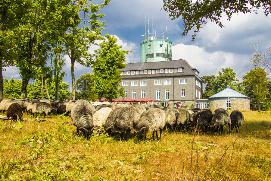
At Lennequelle, you have reached the summit plateau of Kahler Asten mountain. Turn right to Asten tower. Not only does it feature a cosy pub, it is also home to an interesting natural science exhibition. Now leave Rothaarsteig trail, and follow path X6, and then N. It takes you down to the road. Cross the road to the right, and soon find yourself at Wetzstein quarry, where you can marvel at extraordinary rock formations.
Continue in a bend around the south face of Wetzstein mountain. Between the first and second switchback, at the junction, turn left to get to a mountain hut and to reach path N3. Follow it along the east face of Ruhberg mountain to Mollseifen.
From the town centre, follow trail WHT to Odeborntal valley. Follow the road, then go a few steps to the right until you turn left onto N1 to Langewiese. Now you cross the idyllic Bachtal valley, which you leave on a short and steep uphill slope.
At the town, turn right and then left to the church. You are now back on Rothaarsteig. As you leave the town you find an information board that explains the history of the boarder trail. Follow the path along the mountain ridge. At the junction near Lenneplätze, turn right onto N2 and get to the federal road. Now simply walk back to the car park.
Interesting facts
- You're traveling a distance of 14 km on this moderate trail. The average length of all hikes in North Rhine-Westphalia is 49 km.
- Elevated between 554 m and 838 m, the hike is among the 3 highest elevated hikes in North Rhine-Westphalia. You're facing an uphill climb of 403 vertical meters on this hike.
- You shouldn’t forget to bring your hiking boots. There are some sections on the trail where sturdy footwear is required. There are places to buy beverages and food along the track. However it’s always recommended to bring enough water and food along with you.
Highlights of the tour
The view over Lennetal valles and the Sauerland mountains is very impressive.