Route description
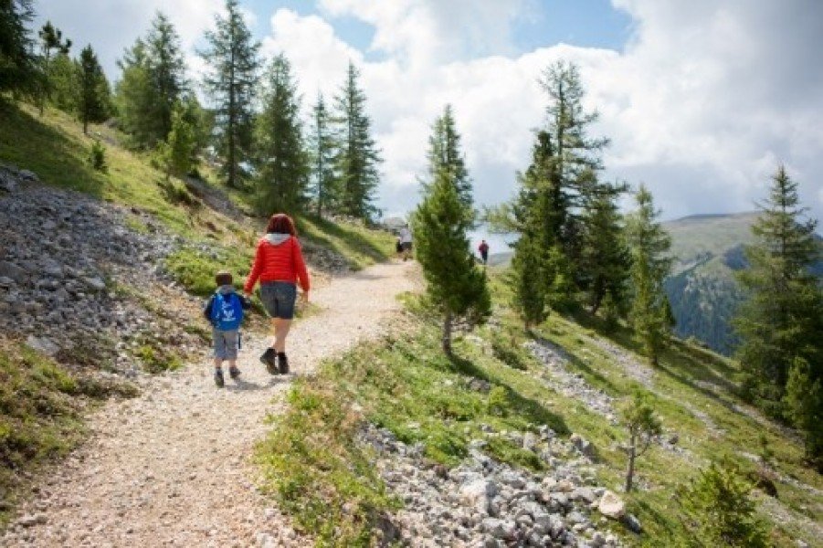
An easy hike across alpine meadows below the impressive mountain scenery of the Latemar and the Zanggen.Route: Obereggen (1550m) – upper car park lot – “Alm” trail n. 9 – uphill to the Malga Epircher Laner (40 min.) – trail 9 after 1km take the left path up to the Malga Mayrl (30 min.) or continue on the trail 9 Passo di Pampeago/Reiterjoch (1996m) to Malga Ganischger and Malga Zischg (30 min). Return: Back to the Malga Mayrl and, in 20 min., to the top station of the Oberholz chairlift. (50 min. from the Malga Zischg or back on path n. 9.
Where to eat
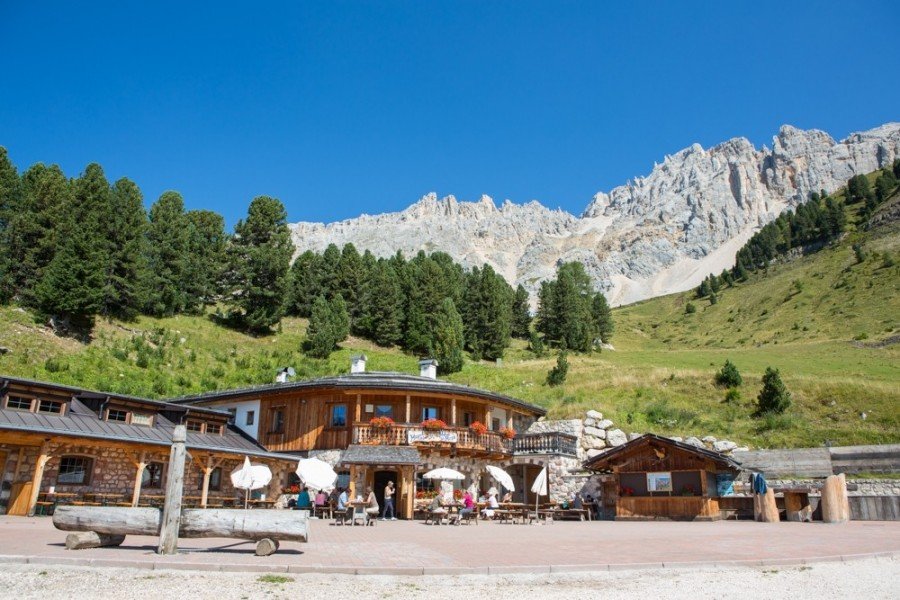
Malga Ganischger, Malga Zischg, Malga Mayrl, Malga Epircher Laner
Interesting facts
- You're traveling a distance of 11 km on this moderate trail. The average length of all hikes in South Tyrol is 12 km.
- You're facing an uphill climb of 497 vertical meters on this hike. The high point of the hike is located at an elevation of 2,014 m.
- This moderate hike is perfect for the whole family. What’s even better: You can also bring the family’s best friend on this dog friendly hike. (See all dog friendly hikes in South Tyrol.)
- In case of good weather conditions, the hike can also be done without bringing your hiking boots. There are places to buy beverages and food along the track. However it’s always recommended to bring enough water and food along with you.
Getting here
Take highway's exit “Bolzano Nord/Eggental”, turn right direction Bolzano/Bozen, after about 0,5 km on roundabout keep left and head towards Val d’Ega (SS 241). Keep driving up to Ponte Nova. At Ponte Nova’s crossroads, turn to the right and continue to Obereggen (about 25 min. from highway toll booth).