Around Me
Search
List
Map
Combined
+
+
Guide
Europe
Germany
Austria
Italy
Switzerland
France
Spain
Greece
Great Britain and Northern Ireland
Czech Republic
Liechtenstein
Iceland
Romania
Belgium
Hungary
Portugal
Slovakia
Ireland
Netherlands
Denmark
Norway
Finland
Malta
Sweden
Slovenia
Lithuania
Serbia
Ukraine
Poland
North America
USA
Canada
Costa Rica
Oceania
New Zealand
Australia
Africa
Egypt
South Africa
Asia
Japan
China
United Arab Emirates
Turkey
India
Azerbaijan
Georgia
Iran
Russia
South America
Brazil
Hiking
Europe
Austria
Germany
Italy
Switzerland
Liechtenstein
France
Iceland
Romania
Belgium
Ireland
Norway
Great Britain and Northern Ireland
Denmark
Sweden
Spain
Portugal
North America
USA
Canada
Oceania
New Zealand
Australia
Biking
Europe
Austria
Germany
Switzerland
Italy
Romania
Spain
Liechtenstein
Great Britain and Northern Ireland
Lithuania
Finland
France
Iceland
Ireland
North America
Canada
USA
Swimming
Europe
Austria
Germany
Switzerland
Italy
Romania
Iceland
Hungary
Spain
Belgium
Slovenia
Malta
Ireland
Netherlands
Great Britain and Northern Ireland
North America
Canada
USA
Attractions
Europe
Germany
Austria
Italy
France
Switzerland
Spain
Greece
Czech Republic
Portugal
Slovakia
Great Britain and Northern Ireland
Hungary
Belgium
Netherlands
Iceland
Ireland
Denmark
Finland
Malta
Liechtenstein
Norway
Romania
Sweden
Serbia
Slovenia
Ukraine
Poland
North America
USA
Canada
Costa Rica
Oceania
New Zealand
Australia
Africa
Egypt
South Africa
Asia
Japan
United Arab Emirates
China
Iran
Georgia
India
Azerbaijan
Turkey
Russia
South America
Brazil
Magazine
News
Award
Active
Culture
Tips
Specials
On Tour
Inside
Hike From Bodenmais via Rissloch Waterfalls to Mount Arber - Image Gallery
Hike
Weather For Hikers
Webcams
Wall
Photos
From Bodenmais via Rissloch Waterfalls to Mount...
Hike
Photos
Weather For Hikers
Webcams
Hikes
Europe
Austria
Germany
Bavaria
Allgäu
Bavarian Forest
Berchtesgadener Land
Zugspitz-Region
Tölzer Land
Passau and Surroundings
Chiemgau
Uper Palatine Forest
Bavarian Jura
Naturpark Altmühltal
Swabia (Bavaria)
North Rhine-Westphalia
Baden-Württemberg
Saxony
Lower Saxony
Thuringia
Rhineland-Palatinate
Saarland
Brandenburg
Mecklenburg-Western Pomerania
Saxony-Anhalt
Italy
Switzerland
Liechtenstein
France
Iceland
Denmark
Great Britain and Northern Ireland
All countries in Europe
Romania
Belgium
Norway
Ireland
Sweden
Portugal
Spain
North America
Canada
USA
Oceania
New Zealand
Australia
Magazine
News
Award
Active
Culture
Tips
All magazine categories
Specials
On Tour
Inside
Misc.
The Perfect Match
Travel Guide
Map
Sweepstakes
Surveys
© A. Berger
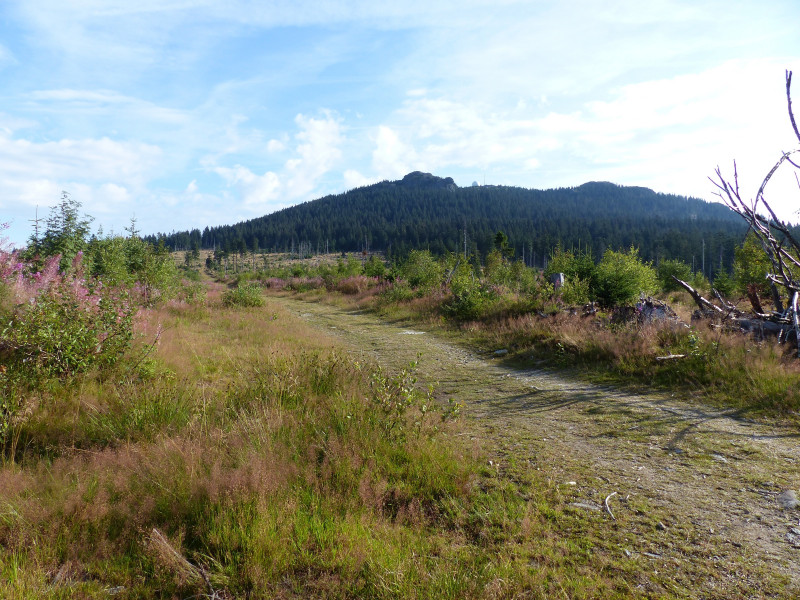
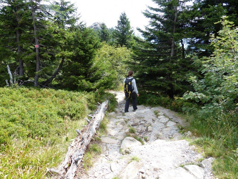
Beginning of Arbersteig trail with view of the summit.
© A. Berger
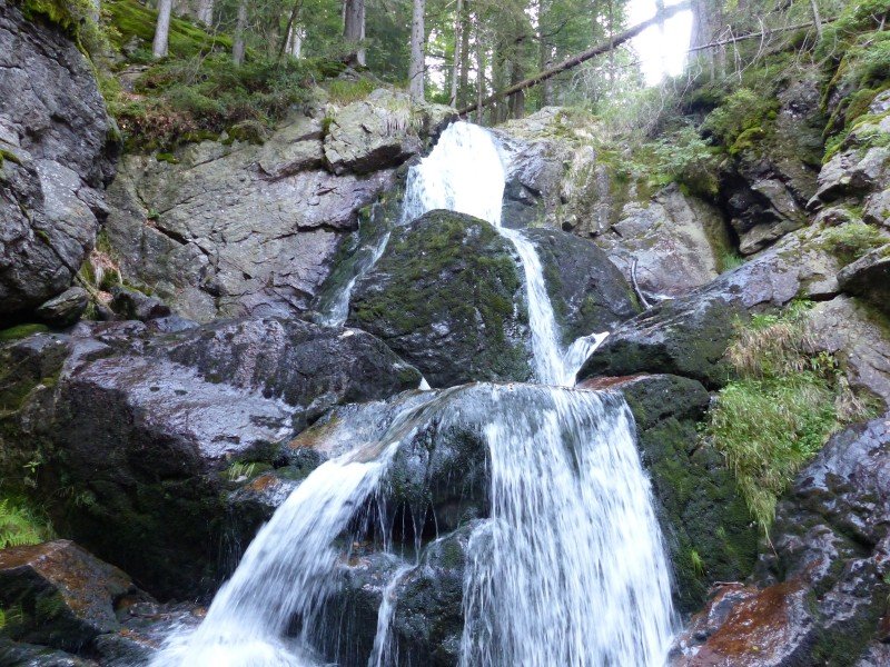
Schwellbach underneath Rißlochfälle waterfalls.
© A. Berger
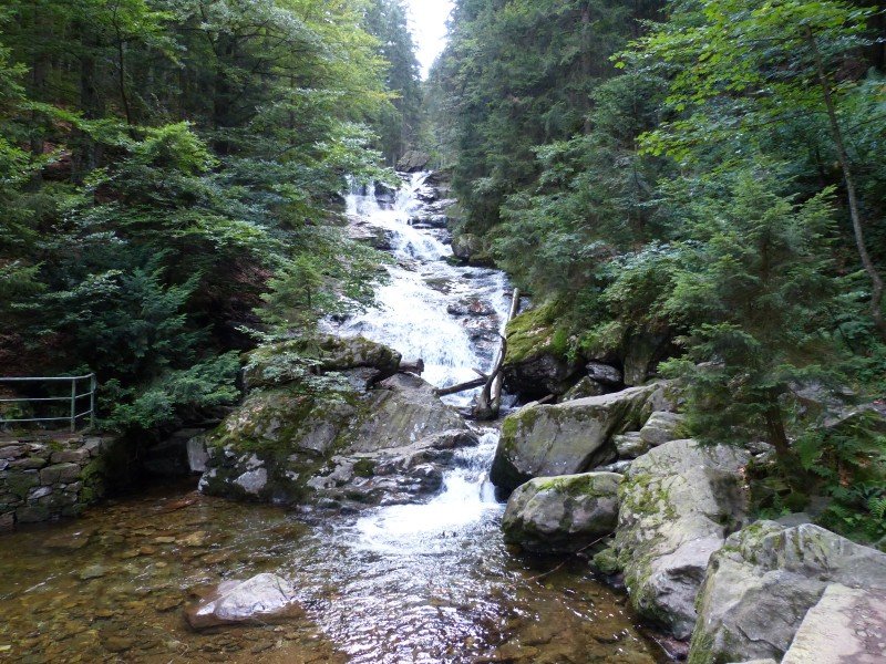
Rißlochfälle Waterfalls.
© A. Berger
Path up to Arberschachten.
© A. Berger
Arberschachten
© A. Berger
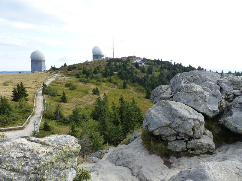
View from Richard-Wagner-Kopf over the summit plateau.
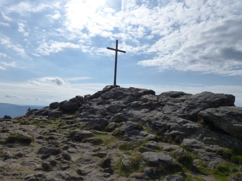
© A. Berger
Summit cross
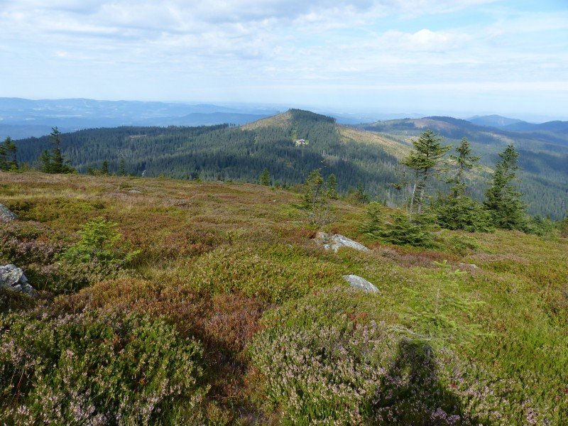
© A. Berger
View over to Kleiner Arber mountain
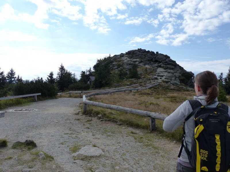
© A. Berger
Seeriegel
© A. Berger
Descent to Bodenmaiser Mulde
© A. Berger
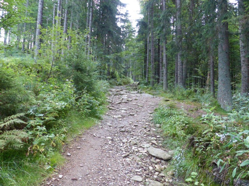
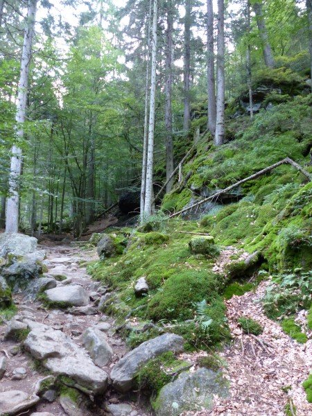
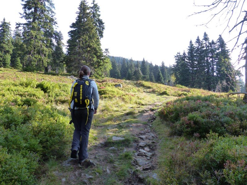
Rocky path to Rißloch Waterfalls
© A. Berger
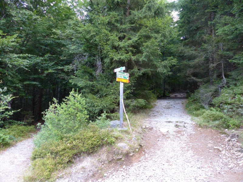
Paths to Rißloch waterfalls: more rocky, challenging trail to the left, easier trial to the right.
© A. Berger
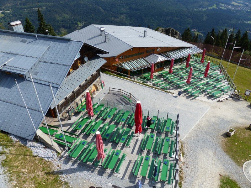
View of Arberschutzhaus and Eisensteiner Hütt'n
© A. Berger
Descent to Bodenmaiser Mulde
© A. Berger
Hiking car park Rißlochfälle in Bodenmais
Weather
(1,456
m
)
Today
25
°C
Mon
23
°C
Tue
23
°C
Weather Forecast
Webcams
All Webcams
Nearby
Lake Kleiner Arbersee
1.9
km
From Bodenmais via Rissloch Waterfalls to Mount Arber
4.2
km
Silberberg Coaster in Bodenmais
6.3
km
Show all
Großer Osser via Zwercheck
7.3
km
Panoramic Trail around Zwiesel
13
km
Böhmweg Trail
29.8
km
About the author
Andrea Berger
last update on 12 Jun 2019
Rate the Hike
2
(2)
Share this page
Share
Tweet
Mail
Advertisement
Login