Contents
Route description
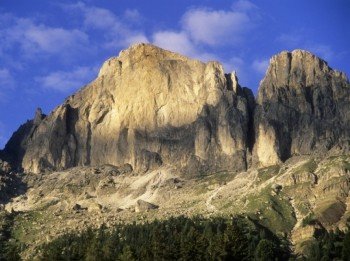
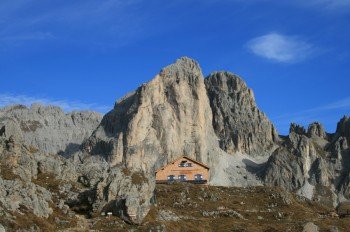
Very nice excursion in the heart of the Catinaccio massif. The hike offers a fantastic view of the nearby mountains.Route: Passo Costalunga/Karer Pass – path n. 552 – Hirzel path – path n. 9 – Passo Vajolon/Vajolon Pass – path n. 551 – path n. 541 – Rifugio Roda di Vael – path n. 548 – Passo Costalunga.Challenging hike; walkers must be well-equipped and have a head for heights.
Sturdy shoes necessary
Overnight stay available
Eating options available
Interesting facts
- You're traveling a distance of 10 km on this strenuous trail. The hike is therefore not too long. Average length of all hikes in South Tyrol is 12 km.
- The heart of Catinaccio/Rosengarten - Vaiolon is among the 15 best rated Hikes in Italy.
- Elevated between 1,749 m and 2,521 m, the hike is among the 15 highest elevated hikes in Italy. You're facing an uphill climb of 831 vertical meters on this hike.
- Sturdy hiking boots are recommended on this track. If you get hungry along the way, there are places to rest and get food. Nevertheless it’s recommended to also have enough water and food in your backpack when hiking or biking.
Getting here
Take highway's exit “Bolzano Nord/Eggental”, turn right direction Bolzano/Bozen, after about 0,5 km on roundabout keep left and head towards Val d’Ega (SS 241). Keep driving up to Ponte Nova. At Ponte Nova’s crossroads, turn to the left and continue to Nova Levante and Passo Costalunga (about 25 min. from highway toll booth).


