Route description
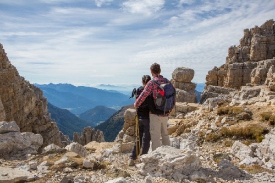
This is a medium-difficult hike over mountain slopes and rocky terrain to the Latemar, on to the Forcella dei Camosci Gap, over the summit and to the Rifugio Torre di Pisa. It affords a beautiful panoramic view.Route: Obereggen (1550m) – ascend with the Oberholz chairlift to 2150 m – uphill on trail n. 18 – Forcella dei Camosci Gap (2560m) – trail n. 516 – Rifugio Torre di Pisa. Descend via trails n. 516 and n. 22 – Mayrlboden (2037m). Return via the Oberholz chairlift to Obereggen.
Where to eat
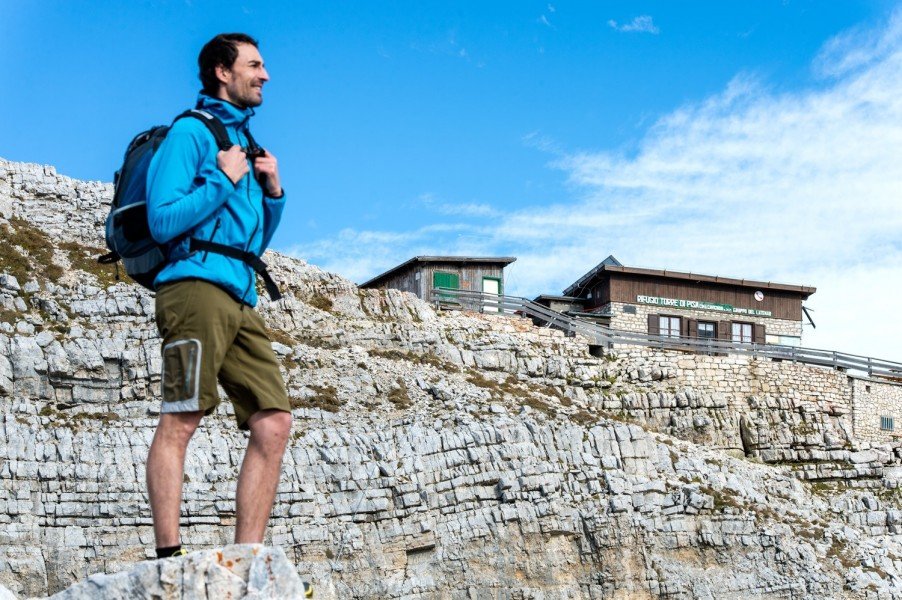
Rifugio Torre di Pisa, Malga Mayrl, Malga Ganischger, Malga Zischg, Malga Epircher Laner
Interesting facts
- You're traveling a distance of 8 km on this strenuous trail. The hike is therefore not too long. Average length of all hikes in South Tyrol is 12 km.
- Elevated between 2,046 m and 2,686 m, the hike is among the 10 highest elevated hikes in Italy. You're facing an uphill climb of 776 vertical meters on this hike.
- You shouldn’t forget to bring your hiking boots. There are some sections on the trail where sturdy footwear is required. If you get hungry along the way, there are places to rest and get food. Nevertheless it’s recommended to also have enough water and food in your backpack when hiking or biking.
Variations
Down path n. 516 to the Passo Feudo – path n. 504 to the Malga Zischg and Malga Ganischger – path n. 9 back to Obereggen.
Getting here
Take highway's exit “Bolzano Nord/Eggental”, turn right direction Bolzano/Bozen, after about 0,5 km on roundabout keep left and head towards Val d’Ega (SS 241). Keep driving up to Ponte Nova. At Ponte Nova’s crossroads, turn to the right and continue to Obereggen (about 25 min. from highway toll booth).